


Itinerario Processione Fontainemore Oropa

SityTrail - itinéraires balisés pédestres
Tous les sentiers balisés d’Europe GUIDE+
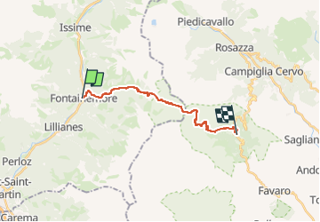

Length
15.9 km

Max alt
2251 m

Uphill gradient
1487 m
Km-Effort
34 km

Min alt
771 m

Downhill gradient
1074 m
Boucle
No

Signpost
Creation date :
2022-02-15 04:45:39.499
Updated on :
2022-03-01 02:06:11.859
7h48
Difficulty : Difficult

FREE GPS app for hiking
 SityTrail
IGN / Geographical institutes
SityTrail Plus
The world is yours!
About
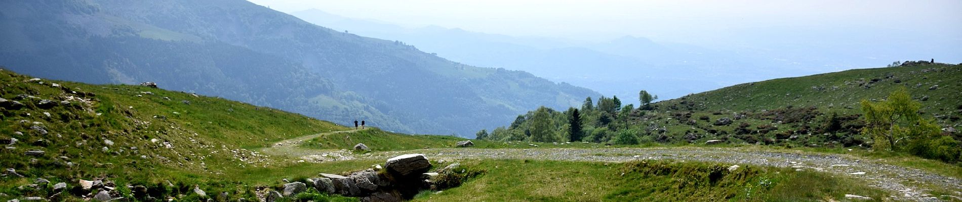
Trail On foot of 15.9 km to be discovered at Aosta Valley, Unknown, Fontainemore. This trail is proposed by SityTrail - itinéraires balisés pédestres.
Description
Trail created by Comune di Fontainemore.
Photos


Positioning
Country:
Italy
Region :
Aosta Valley
Department/Province :
Unknown
Municipality :
Fontainemore
Location:
Unknown
Start:(Dec)
Start:(UTM)
411114 ; 5055591 (32T) N.
Comments