


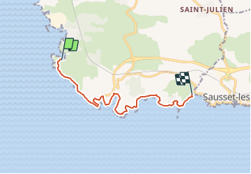

21 km | 24 km-effort

Tous les sentiers balisés d’Europe PRO


FREE GPS app for hiking
 SityTrail
IGN / Geographical institutes
SityTrail World
The world is yours!
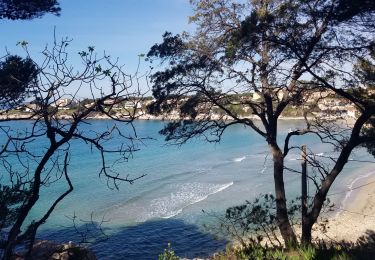
Trail On foot of 10.4 km to be discovered at Provence-Alpes-Côte d'Azur, Bouches-du-Rhône, Martigues. This trail is proposed by SityTrail - itinéraires balisés pédestres.
Trail created by Département des Bouches-du-Rhône.
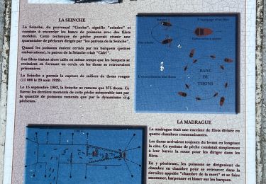
Le sentier est balisé en Rouge et Blanc. GR ? GR 51 ?
Symbol: white and red bars


Walking
Walking
On foot
On foot
On foot

On foot
Walking

sport
On foot