


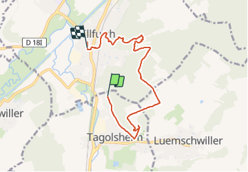
22 02 22 VTM Illfurth

jmbilger
User

Length
6.5 km

Max alt
382 m

Uphill gradient
172 m
Km-Effort
8.9 km

Min alt
260 m

Downhill gradient
210 m
Boucle
No
Creation date :
2022-02-22 13:38:08.0
Updated on :
2022-03-17 07:18:37.868
2h02
Difficulty : Difficult

FREE GPS app for hiking
 SityTrail
IGN / Geographical institutes
SityTrail Plus
The world is yours!
About
Trail Walking of 6.5 km to be discovered at Grand Est, Haut-Rhin, Tagolsheim. This trail is proposed by jmbilger.
Positioning
Country:
France
Region :
Grand Est
Department/Province :
Haut-Rhin
Municipality :
Tagolsheim
Location:
Unknown
Start:(Dec)
Start:(UTM)
370055 ; 5280359 (32T) N.
Comments