


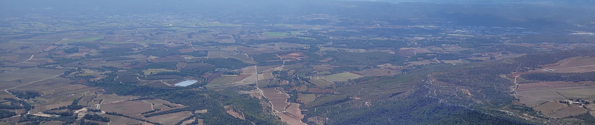
le pic des mouches et la citadelle

amiral13
User GUIDE
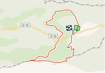

Length
11.4 km

Max alt
998 m

Uphill gradient
520 m
Km-Effort
18.3 km

Min alt
583 m

Downhill gradient
523 m
Boucle
Yes
Creation date :
2022-02-27 09:14:10.457
Updated on :
2022-02-27 17:32:03.757
3h53
Difficulty : Easy

FREE GPS app for hiking
 SityTrail
IGN / Geographical institutes
SityTrail Plus
The world is yours!
About
Trail Walking of 11.4 km to be discovered at Provence-Alpes-Côte d'Azur, Bouches-du-Rhône, Vauvenargues. This trail is proposed by amiral13.
Photos


Positioning
Country:
France
Region :
Provence-Alpes-Côte d'Azur
Department/Province :
Bouches-du-Rhône
Municipality :
Vauvenargues
Location:
Unknown
Start:(Dec)
Start:(UTM)
715942 ; 4825440 (31T) N.
Comments