157 TraceGps issued

houbart
User
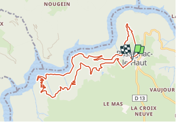

Length
11.9 km

Max alt
543 m

Uphill gradient
474 m
Km-Effort
18.2 km

Min alt
268 m

Downhill gradient
475 m
Boucle
Yes
Creation date :
2022-02-27 16:03:59.069
Updated on :
2022-03-31 14:46:39.883
4h08
Difficulty : Difficult

FREE GPS app for hiking
 SityTrail
IGN / Geographical institutes
SityTrail Plus
The world is yours!
About
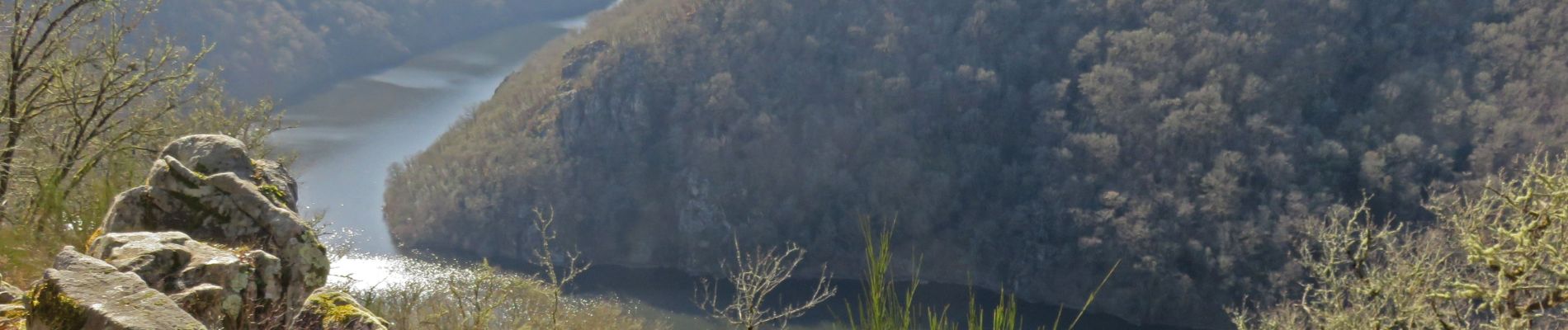
Trail Walking of 11.9 km to be discovered at New Aquitaine, Corrèze, Bassignac-le-Haut. This trail is proposed by houbart.
Photos


Positioning
Country:
France
Region :
New Aquitaine
Department/Province :
Corrèze
Municipality :
Bassignac-le-Haut
Location:
Unknown
Start:(Dec)
Start:(UTM)
427146 ; 5006817 (31T) N.
Comments