Trail Walking Colletot - Colletot à Corneille sur Risle - Photo

Colletot à Corneille sur Risle

© OpenStreetMap contributors
Length
Length
11.3 km
Max alt
Max alt
128 m
Uphill gradient
Uphill gradient
154 m
Km-Effort
Km-Effort  
13.4 km
Min alt
Min alt
23 m
Downhill gradient
Downhill gradient
154 m
Boucle
Boucle
Yes
Creation date :
2022-03-09 13:28:41.189
Updated on :
2022-03-09 16:19:39.415

(1 Reviews)

Walking
Walking
2h50
Difficulty : Difficult

Scan this QR Code to open this trail in the SityTrail application

FREE GPS app for hiking

Logo SityTrail SityTrail

IGN / Geographical institutes

Download SityTrail from the App Store Download SityTrail from Google Play

Logo SityTrail SityTrail World

The world is yours!

Download SityTrail from the App Store Download SityTrail from Google Play Download SityTrail on Huawei AppGallery

About

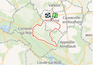
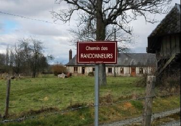
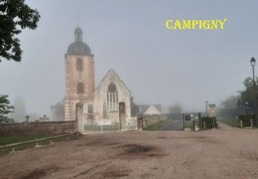
Trail Walking of 11.3 km to be discovered at Normandy, Eure, Colletot. This trail is proposed by MichelRando7656.

Description

Quelques petites routes de campagne pour les traversées de village. Beaucoup de chemins forestiers et de campagne. Beau temps pour la promenade. A découvrir ou redécouvrir.

Elevation profile

Photos

Positioning

Country:
France
Region :
Normandy
Department/Province :
Eure
Municipality :
Colletot
Location:
Unknown
Start:(UTM)
327110 ; 5469019 (31U) N.

Comments

Please log in to post a review or rate the element


Trails nearby

Trail Walking Condé-sur-Risle - Circuit des faneuses -Condé sur Risle-St Christophe sur Condé  - Photo
Walking
MichelRando7656

Walking

Difficult
Condé-sur-Risle, Normandy, Eure, France
14 km | 16.4 km-effort
4h 8min
Yes
Trail Walking Bourneville-Sainte-Croix - Bourneville-sainte-Croix- Le petit Brotonne  - Photo
Walking
MichelRando7656

Walking

Difficult
Bourneville-Sainte-Croix, Normandy, Eure, France
14.1 km | 16.2 km-effort
3h 23min
Yes
Trail Walking Cauverville-en-Roumois - Cauverville en Roumois - Le chemin du chênede la Vierge - Photo
Walking
MichelRando7656

Walking

Difficult
(1)
Cauverville-en-Roumois, Normandy, Eure, France
11.7 km | 13.9 km-effort
3h 6min
Yes
Trail Walking Appeville-Annebault - Appeville Annebault - Photo
Walking
Roulland

Walking

Medium
(1)
Appeville-Annebault, Normandy, Eure, France
26 km | 33 km-effort
4h 42min
Yes
Trail Walking Appeville-Annebault - appeville - Photo
Walking
MichelRando7656

Walking

Medium
Appeville-Annebault, Normandy, Eure, France
23 km | 29 km-effort
5h 6min
Yes
Trail Walking Le Perrey - chemin des Têtards - Photo
Walking
dominiquelouis

Walking

Medium
Le Perrey, Normandy, Eure, France
7.8 km | 9.2 km-effort
2h 21min
Yes
Trail Walking Colletot - Colletot - Photo
Walking
ymarvin27

Walking

Easy
Colletot, Normandy, Eure, France
6.5 km | 7.8 km-effort
1h 30min
Yes
Trail Walking Campigny - 20230913-Campigny claude - Photo
Walking
doudet

Walking

Medium
Campigny, Normandy, Eure, France
7.9 km | 10.2 km-effort
2h 26min
Yes
Trail Walking Condé-sur-Risle - Condé sur Risle - Photo
Walking
Eve - Line

Walking

Medium
(2)
Condé-sur-Risle, Normandy, Eure, France
13.6 km | 16.1 km-effort
3h 15min
Yes


Close
My subscriptions