


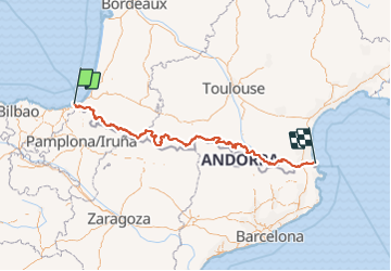
GR 10 : Traversée des Pyrénées

chasle
User

Length
900 km

Max alt
2744 m

Uphill gradient
54922 m
Km-Effort
1632 km

Min alt
0 m

Downhill gradient
54927 m
Boucle
No
Creation date :
2022-03-13 10:04:44.842
Updated on :
2022-03-13 10:20:54.198

FREE GPS app for hiking
 SityTrail
IGN / Geographical institutes
SityTrail Plus
The world is yours!
About
Trail of 900 km to be discovered at New Aquitaine, Pyrénées-Atlantiques, Hendaye. This trail is proposed by chasle.
Positioning
Country:
France
Region :
New Aquitaine
Department/Province :
Pyrénées-Atlantiques
Municipality :
Hendaye
Location:
Unknown
Start:(Dec)
Start:(UTM)
599318 ; 4802982 (30T) N.
Comments