Trail Walking Sainte-Fortunade - Les Puys de Sainte Fortunade - version courte - Sainte Fortunade  - Photo

Les Puys de Sainte Fortunade - version courte - Sainte Fortunade

 tracegps
tracegps

User

© OpenStreetMap contributors
Length
Length
10.4 km
Max alt
Max alt
562 m
Uphill gradient
Uphill gradient
265 m
Km-Effort
Km-Effort  
14 km
Min alt
Min alt
383 m
Downhill gradient
Downhill gradient
264 m
Boucle
Boucle
Yes
Creation date :
2014-12-10 00:00:00.0
Updated on :
2014-12-10 00:00:00.0

(0 Reviews)

Walking
Walking
2h30
Difficulty : Medium

Scan this QR Code to open this trail in the SityTrail application

FREE GPS app for hiking

Logo SityTrail SityTrail

IGN / Geographical institutes

Download SityTrail from the App Store Download SityTrail from Google Play

Logo SityTrail SityTrail World

The world is yours!

Download SityTrail from the App Store Download SityTrail from Google Play Download SityTrail on Huawei AppGallery

About

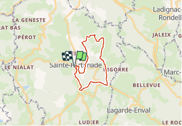
Trail Walking of 10.4 km to be discovered at New Aquitaine, Corrèze, Sainte-Fortunade. This trail is proposed by tracegps.

Description

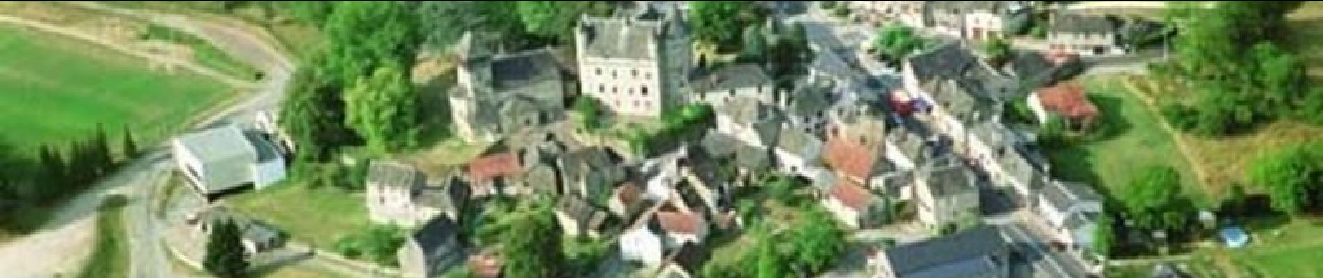
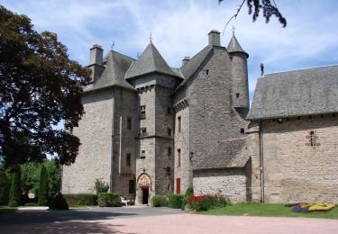
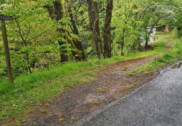
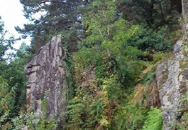
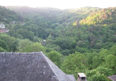
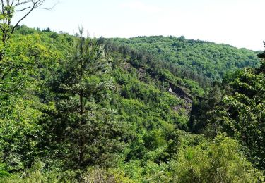
Variante courte. A son point de départ, le circuit vous présente la richesse patrimoniale de Sainte-Fortunade : son église bâtie autour d'un chœur roman, et bien sûr son château du XVe siècle aux pièces monumentales inscrit dans un joli parc du XIXe flanqué d'une orangerie... Traversez le vieux village du Barry-Bas puis approchez les chapelles de Chabrignac et des Métayers tout en profitant de remarquables panoramas sur les Monédières, les Monts d'Auvergne... Téléchargez la fiche du circuit sur le site du Tourisme en Limousin.

Elevation profile

Photos

Positioning

Country:
France
Region :
New Aquitaine
Department/Province :
Corrèze
Municipality :
Sainte-Fortunade
Location:
Unknown
Start:(UTM)
403486 ; 5006680 (31T) N.

Trails nearby

Trail Walking Sainte-Fortunade - Les Puys de Sainte Fortunade - Sainte Fortunade - Pays de Tulle - Photo
Walking
tracegps

Walking

Difficult
(1)
Sainte-Fortunade, New Aquitaine, Corrèze, France
19.2 km | 26 km-effort
6h 0min
Yes
Trail Walking Laguenne-sur-Avalouze - Laguenne Chemin des Puys - Photo
Walking
houbart

Walking

Medium
(1)
Laguenne-sur-Avalouze, New Aquitaine, Corrèze, France
9.5 km | 14.1 km-effort
3h 2min
Yes
Trail Walking Laguenne-sur-Avalouze - Camping le pre du moulin - Photo
Walking
Geronimo2010

Walking

Easy
(1)
Laguenne-sur-Avalouze, New Aquitaine, Corrèze, France
4.9 km | 6.5 km-effort
1h 4min
Yes
Trail Walking Aubazines - Reco-Lac de Coiroux-2024-04-25 - Photo
Walking
GUIDE
Nordic33

Walking

Difficult
Aubazines, New Aquitaine, Corrèze, France
18.1 km | 24 km-effort
6h 19min
Yes
Trail Walking Aubazines - Lac du Coiroux, Aubazine, Canal des Moines - Photo
Walking
nicolibris

Walking

Medium
Aubazines, New Aquitaine, Corrèze, France
8.3 km | 10.8 km-effort
2h 45min
Yes
Trail Walking Aubazines - Du Coiroux à Aubazines - Photo
Walking
tracegps

Walking

Medium
Aubazines, New Aquitaine, Corrèze, France
4.7 km | 6 km-effort
2h 30min
No
Trail Walking Sainte-Fortunade - Fred ste fortunade  - Photo
Walking
arnoultjf

Walking

Very easy
Sainte-Fortunade, New Aquitaine, Corrèze, France
8.2 km | 11.4 km-effort
2h 46min
Yes
Trail Walking Aubazines - Parcours nature du Coiroux - Aubazine - Photo
Walking
tracegps

Walking

Medium
Aubazines, New Aquitaine, Corrèze, France
7.6 km | 9.6 km-effort
2h 0min
Yes
Trail Mountain bike Lagarde-Marc-la-Tour - Circuit des ruisseaux et de la châtaigneraie - Lagarde Enval - Pays de Tulle - Photo
Mountain bike
tracegps

Mountain bike

Medium
Lagarde-Marc-la-Tour, New Aquitaine, Corrèze, France
17.2 km | 22 km-effort
1h 30min
Yes


Close
My subscriptions