Trail Walking Morlaix - GR 34® de Morlaix à Carantec - Photo

GR 34® de Morlaix à Carantec

 tracegps
tracegps

User

© OpenStreetMap contributors
Length
Length
26 km
Max alt
Max alt
91 m
Uphill gradient
Uphill gradient
537 m
Km-Effort
Km-Effort  
33 km
Min alt
Min alt
0 m
Downhill gradient
Downhill gradient
557 m
Boucle
Boucle
No
Creation date :
2014-12-10 00:00:00.0
Updated on :
2014-12-10 00:00:00.0

(0 Reviews)

Walking
Walking
5h40
Difficulty : Difficult

Scan this QR Code to open this trail in the SityTrail application

FREE GPS app for hiking

Logo SityTrail SityTrail

IGN / Geographical institutes

Download SityTrail from the App Store Download SityTrail from Google Play

Logo SityTrail SityTrail World

The world is yours!

Download SityTrail from the App Store Download SityTrail from Google Play Download SityTrail on Huawei AppGallery

About

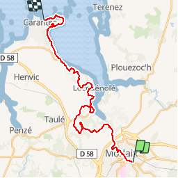
Trail Walking of 26 km to be discovered at Brittany, Finistère, Morlaix. This trail is proposed by tracegps.

Description

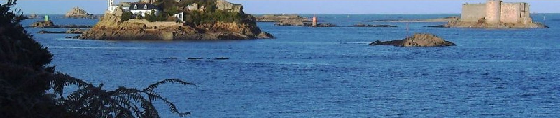
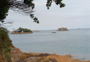
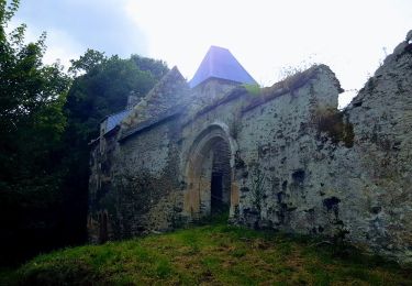
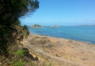
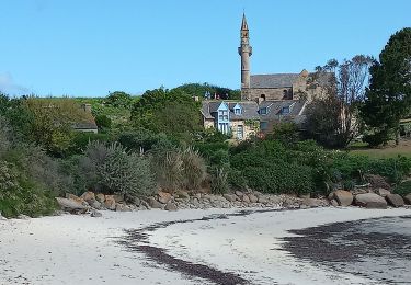
GR34® Les Abers - GR 34® de Morlaix à Carantec - Entre Morlaix et Brest, la côte rocheuse est profondément découpée en criques, en rias, grèves et plages. Bon nombre de récifs et d'îlots la bordent (îles de Batz et Ouessant, archipel de Molène). La structure du massif granitique et les assauts répétés de la mer expliquent la création de sillons étroits et profonds : les Abers. Au fil du sentier, le randonneur longe les bords de l'Aber Vrac'h, de l'Aber Benoît ou de l'Aber Ildut. Ils constituent autant d'abris pour les plaisanciers, les flottilles de pêche côtière, les sabliers et goémoniers. Sur les rives de cette Finis-terrae, la faune marine est d'une extraordinaire richesse : colonies d'oiseaux et mammifères marins rares (phoques, dauphins, loutres d'Europe). Vous trouverez le descriptif détaillé de cette randonnée dans le Topo-guide® de la Fédération Française de la Randonnée Pédestre. Le découpage proposé ici est donné à titre indicatif pour équilibrer la distance de chaque tronçon. Chacun peut l’adapter à son niveau. Pour toute information complémentaire sur la randonnée : Comité départemental du Finistère: 4 ROUTE DE ST RENAN BP 02 29810 PLOUARZEL Tél. : 0298896006

Elevation profile

Photos

Positioning

Country:
France
Region :
Brittany
Department/Province :
Finistère
Municipality :
Morlaix
Location:
Unknown
Start:(UTM)
439376 ; 5380712 (30U) N.

Trails nearby

Trail Walking Saint-Martin-des-Champs - 29.08.23  Morlaix -- Carantec - Photo
Walking
donda

Walking

Very difficult
Saint-Martin-des-Champs, Brittany, Finistère, France
22 km | 28 km-effort
6h 16min
No
Trail On foot Saint-Martin-des-Champs - Vallée de la Pennélé - Photo
On foot
PRO

On foot

Easy
Saint-Martin-des-Champs, Brittany, Finistère, France
6.5 km | 7.9 km-effort
1h 48min
No
Trail On foot Taulé - Circuit du Bois de Lannigou - Photo
On foot
PRO

On foot

Easy
Taulé, Brittany, Finistère, France
3.1 km | 4.1 km-effort
55min
Yes
Trail Walking Saint-Martin-des-Champs - Bretagne Nord J4 De Morlaix à Plougasnou - Photo
Walking
chessyca

Walking

Medium
Saint-Martin-des-Champs, Brittany, Finistère, France
25 km | 30 km-effort
5h 51min
No
Trail Walking Morlaix - Bretagne nord J3 pm Visite de Morlaix - Photo
Walking
chessyca

Walking

Very easy
Morlaix, Brittany, Finistère, France
6 km | 7.5 km-effort
2h 0min
No
Trail Walking Saint-Martin-des-Champs - GR 34 étape 24 - Photo
Walking
lagardienne

Walking

Easy
Saint-Martin-des-Champs, Brittany, Finistère, France
28 km | 36 km-effort
8h 32min
No
Trail Bicycle tourism Morlaix - De Morlaix à l'île Callot - Photo
Bicycle tourism
ilur56

Bicycle tourism

Medium
Morlaix, Brittany, Finistère, France
41 km | 48 km-effort
5h 36min
No
Trail On foot Sainte-Sève - Tro Sant Sev - Photo
On foot
PRO

On foot

Easy
Sainte-Sève, Brittany, Finistère, France
9.4 km | 10.7 km-effort
2h 25min
Yes
Trail Walking Morlaix - Tour du Trégor morlaisien GR® 380 - GR® 34D: Morlaix - Plouigneau - Photo
Walking
tracegps

Walking

Medium
Morlaix, Brittany, Finistère, France
11 km | 14.6 km-effort
2h 30min
No


Close
My subscriptions