Trail Walking Die - 26 belle justine - Photo
© OpenStreetMap contributors
Length
Length
14.1 km
Max alt
Max alt
1101 m
Uphill gradient
Uphill gradient
704 m
Km-Effort
Km-Effort  
24 km
Min alt
Min alt
454 m
Downhill gradient
Downhill gradient
725 m
Boucle
Boucle
No
Creation date :
2022-03-16 09:07:26.383
Updated on :
2022-03-16 19:33:09.538

(0 Reviews)

Walking
Walking
7h18
Difficulty : Medium

Scan this QR Code to open this trail in the SityTrail application

FREE GPS app for hiking

Logo SityTrail SityTrail

IGN / Geographical institutes

Download SityTrail from the App Store Download SityTrail from Google Play

Logo SityTrail SityTrail World

The world is yours!

Download SityTrail from the App Store Download SityTrail from Google Play Download SityTrail on Huawei AppGallery

About

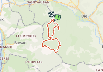
Trail Walking of 14.1 km to be discovered at Auvergne-Rhône-Alpes, Drôme, Die. This trail is proposed by himba26100.

Description

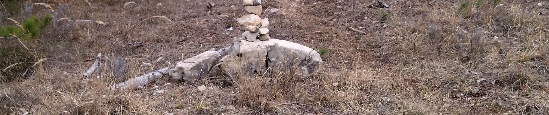
2 jumars corde 3 sangles pour acceder en ht de chateau ruine
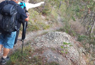
revoir itinéraire. après la crête
prendre route forestier
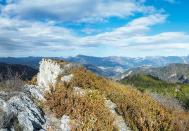
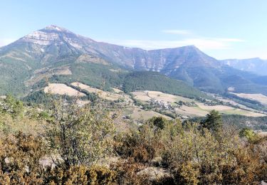
belle rando
gene

Elevation profile

Photos

Positioning

Country:
France
Region :
Auvergne-Rhône-Alpes
Department/Province :
Drôme
Municipality :
Die
Location:
Unknown
Start:(UTM)
684651 ; 4957466 (31T) N.

Trails nearby

Trail Nordic walking Ponet-et-Saint-Auban - 20/12/2015 Pierre plats  - Photo
Nordic walking
fiorano

Nordic walking

Easy
(1)
Ponet-et-Saint-Auban, Auvergne-Rhône-Alpes, Drôme, France
6.9 km | 11.1 km-effort
1h 46min
Yes
Trail Walking Die - Chapia Belle Justine - Photo
Walking
patbt

Walking

Medium
(1)
Die, Auvergne-Rhône-Alpes, Drôme, France
10.7 km | 17.1 km-effort
3h 47min
Yes
Trail Walking Aurel - Vercors - Vercheny Combe Noire - Photo
Walking
Alfredy

Walking

Very easy
(1)
Aurel, Auvergne-Rhône-Alpes, Drôme, France
8.7 km | 12.7 km-effort
2h 55min
Yes
Trail Walking Sainte-Croix - 26 Sainte Croix Crêtes de Ramiat - Photo
Walking
Maryma

Walking

Very difficult
Sainte-Croix, Auvergne-Rhône-Alpes, Drôme, France
17.5 km | 30 km-effort
6h 42min
Yes
Trail sport Die - Croix de Justin , Ausson  - Photo
sport
alinetpierre

sport

Very easy
Die, Auvergne-Rhône-Alpes, Drôme, France
14.7 km | 24 km-effort
Unknown
Yes
Trail Walking Die - Autour de Die balade - Photo
Walking
jll7513

Walking

Easy
Die, Auvergne-Rhône-Alpes, Drôme, France
8.9 km | 11.7 km-effort
1h 56min
Yes
Trail Walking Die - la Belle Justine ( rando Asptt)  - Photo
Walking
TOULAUDIN

Walking

Medium
Die, Auvergne-Rhône-Alpes, Drôme, France
14.8 km | 24 km-effort
5h 36min
Yes
Trail Walking Die - La belle justine - Photo
Walking
AIGUIER

Walking

Medium
Die, Auvergne-Rhône-Alpes, Drôme, France
13.7 km | 21 km-effort
3h 1min
Yes
Trail Walking Ponet-et-Saint-Auban - Ponet-et-St-Auban - Montagne de Desse - Marignac - Photo
Walking
Philindy26

Walking

Medium
Ponet-et-Saint-Auban, Auvergne-Rhône-Alpes, Drôme, France
11.6 km | 21 km-effort
3h 30min
Yes


Close
My subscriptions