Trail Walking Sourdon - Autour d'Ainval - Sourdon - Photo

Autour d'Ainval - Sourdon

 tracegps
tracegps

User

© OpenStreetMap contributors
Length
Length
10.4 km
Max alt
Max alt
142 m
Uphill gradient
Uphill gradient
142 m
Km-Effort
Km-Effort  
12.3 km
Min alt
Min alt
75 m
Downhill gradient
Downhill gradient
142 m
Boucle
Boucle
Yes
Creation date :
2014-12-10 00:00:00.0
Updated on :
2014-12-10 00:00:00.0

(0 Reviews)

Walking
Walking
3h00
Difficulty : Medium

Scan this QR Code to open this trail in the SityTrail application

FREE GPS app for hiking

Logo SityTrail SityTrail

IGN / Geographical institutes

Download SityTrail from the App Store Download SityTrail from Google Play

Logo SityTrail SityTrail World

The world is yours!

Download SityTrail from the App Store Download SityTrail from Google Play Download SityTrail on Huawei AppGallery

About

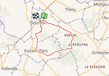
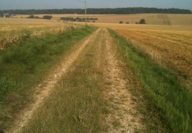
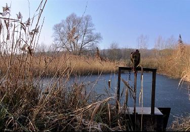
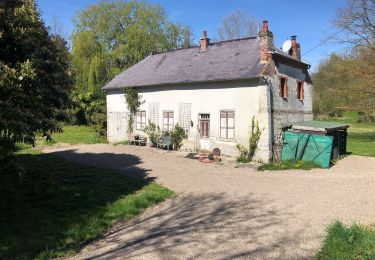
Trail Walking of 10.4 km to be discovered at Hauts-de-France, Somme, Sourdon. This trail is proposed by tracegps.

Description

Départ de l'église de Sourdon vers Ainval. Le précieux bras reliquaire de saint Fiacre, vous indique le chemin du retour depuis l'église d'Esclainvillers. Retrouvez cette randonnée sur le site de l'Office de Tourisme de Val de Noye.

Elevation profile

Photos

Positioning

Country:
France
Region :
Hauts-de-France
Department/Province :
Somme
Municipality :
Sourdon
Location:
Unknown
Start:(UTM)
456702 ; 5506554 (31U) N.

Trails nearby

Trail Walking Ailly-sur-Noye - Bois de Berny - Photo
Walking
sulcata80

Walking

Medium
(1)
Ailly-sur-Noye, Hauts-de-France, Somme, France
10.1 km | 12.1 km-effort
2h 38min
Yes
Trail Walking Grivesnes - Le Langueron - Grivesnes - Photo
Walking
tracegps

Walking

Medium
Grivesnes, Hauts-de-France, Somme, France
13.2 km | 15.6 km-effort
2h 15min
Yes
Trail Mountain bike Ailly-sur-Noye - Circuit n° 4  VTT -  Ailly-sur-Noye - Photo
Mountain bike
tracegps

Mountain bike

Difficult
Ailly-sur-Noye, Hauts-de-France, Somme, France
42 km | 50 km-effort
4h 0min
Yes
Trail Cycle Ailly-sur-Noye - Le Val de Noye - Boucle de Boves - Photo
Cycle
tracegps

Cycle

Medium
Ailly-sur-Noye, Hauts-de-France, Somme, France
27 km | 30 km-effort
1h 30min
Yes
Trail Cycle Ailly-sur-Noye - Le Val de Noye - Boucle de Coullemelle - Photo
Cycle
tracegps

Cycle

Medium
Ailly-sur-Noye, Hauts-de-France, Somme, France
33 km | 38 km-effort
2h 0min
Yes
Trail Walking Folleville - Folleville  - Photo
Walking
jema.bernard

Walking

Very easy
Folleville, Hauts-de-France, Somme, France
6.1 km | 7.5 km-effort
1h 25min
Yes
Trail Walking Chirmont - Johnny  - Photo
Walking
Johnny Ceyssens

Walking

Easy
Chirmont, Hauts-de-France, Somme, France
9.6 km | 11.1 km-effort
1h 57min
Yes
Trail sport Ailly-sur-Noye - Benny - Photo
sport
dedehenry

sport

Very easy
Ailly-sur-Noye, Hauts-de-France, Somme, France
9.8 km | 11.7 km-effort
Unknown
Yes
Trail Running Sourdon - sourdon ainval - Photo
Running
Aslahe

Running

Very easy
Sourdon, Hauts-de-France, Somme, France
11.1 km | 13.6 km-effort
1h 20min
Yes


Close
My subscriptions