Trail Walking Châtel-Guyon - Autour de la vallée des Prades - Chatel-Guyon - Photo

Autour de la vallée des Prades - Chatel-Guyon

 tracegps
tracegps

User

© OpenStreetMap contributors
Length
Length
11 km
Max alt
Max alt
678 m
Uphill gradient
Uphill gradient
345 m
Km-Effort
Km-Effort  
15.6 km
Min alt
Min alt
439 m
Downhill gradient
Downhill gradient
349 m
Boucle
Boucle
Yes
Creation date :
2014-12-10 00:00:00.0
Updated on :
2014-12-10 00:00:00.0

(0 Reviews)

Walking
Walking
3h10
Difficulty : Difficult

Scan this QR Code to open this trail in the SityTrail application

FREE GPS app for hiking

Logo SityTrail SityTrail

IGN / Geographical institutes

Download SityTrail from the App Store Download SityTrail from Google Play

Logo SityTrail SityTrail World

The world is yours!

Download SityTrail from the App Store Download SityTrail from Google Play Download SityTrail on Huawei AppGallery

About

Trail Walking of 11 km to be discovered at Auvergne-Rhône-Alpes, Puy-de-Dôme, Châtel-Guyon. This trail is proposed by tracegps.

Description

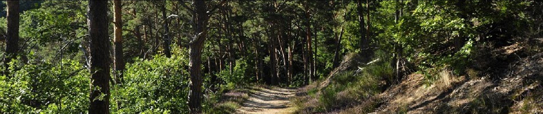
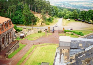
Départ du parking de l'étang des Prades. Rando qui vous fait monter en pente douce jusqu'au château de Chazeron. Puis descente avec vue sur le plateau des Combrailles, et la plaine de Limagne. Le tout se fait sur des chemins ou sentiers en très bon état.

Elevation profile

Photos

Positioning

Country:
France
Region :
Auvergne-Rhône-Alpes
Department/Province :
Puy-de-Dôme
Municipality :
Châtel-Guyon
Location:
Unknown
Start:(UTM)
504849 ; 5086370 (31T) N.

Trails nearby

Trail On foot Loubeyrat - La Vallee des Prades - Photo
On foot
PRO

On foot

Easy
(1)
Loubeyrat, Auvergne-Rhône-Alpes, Puy-de-Dôme, France
11.1 km | 15.6 km-effort
3h 33min
Yes
Trail Walking Enval - Enval_Gorges - Photo
Walking
GUIDE
jagarnier

Walking

Medium
(1)
Enval, Auvergne-Rhône-Alpes, Puy-de-Dôme, France
9.1 km | 13.2 km-effort
2h 45min
Yes
Trail Walking Loubeyrat - Le roc du diable - Prompsat - Photo
Walking
Gegetop

Walking

Medium
(1)
Loubeyrat, Auvergne-Rhône-Alpes, Puy-de-Dôme, France
9.5 km | 13.4 km-effort
2h 20min
Yes
Trail Walking Teilhède - Teilhede - Photo
Walking
Gegetop

Walking

Easy
(1)
Teilhède, Auvergne-Rhône-Alpes, Puy-de-Dôme, France
6.5 km | 8.7 km-effort
1h 38min
Yes
Trail Walking Gimeaux - Chemin de Fontête - Photo
Walking
Gegetop

Walking

Easy
(2)
Gimeaux, Auvergne-Rhône-Alpes, Puy-de-Dôme, France
8.6 km | 11.9 km-effort
2h 6min
Yes
Trail Walking Châtel-Guyon - Les Briffons-Bois d'Agnat - Photo
Walking
Gegetop

Walking

Easy
(2)
Châtel-Guyon, Auvergne-Rhône-Alpes, Puy-de-Dôme, France
10.6 km | 14.8 km-effort
3h 14min
Yes
Trail Walking Châtel-Guyon - Chazeron sans souci - Photo
Walking
Gegetop

Walking

Easy
(1)
Châtel-Guyon, Auvergne-Rhône-Alpes, Puy-de-Dôme, France
6.6 km | 9.7 km-effort
1h 45min
Yes
Trail Walking Châtel-Guyon - Boucle de Rochepradière en passant par Douhady - Photo
Walking
Gegetop

Walking

Easy
(1)
Châtel-Guyon, Auvergne-Rhône-Alpes, Puy-de-Dôme, France
6.7 km | 9.7 km-effort
2h 6min
Yes
Trail Walking Châtel-Guyon - Le tour de Montaclier - Saint Hippolyte - Photo
Walking
tracegps

Walking

Difficult
(1)
Châtel-Guyon, Auvergne-Rhône-Alpes, Puy-de-Dôme, France
14 km | 19.6 km-effort
3h 30min
Yes


Close
My subscriptions