


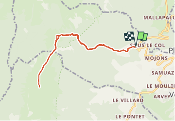
Bauges Mont Orisan en passant par le col du Haut Four

c.gourme
User

Length
10 km

Max alt
1750 m

Uphill gradient
930 m
Km-Effort
22 km

Min alt
826 m

Downhill gradient
935 m
Boucle
Yes
Creation date :
2022-03-17 07:39:01.0
Updated on :
2022-03-17 17:05:09.954
5h31
Difficulty : Difficult

FREE GPS app for hiking
 SityTrail
IGN / Geographical institutes
SityTrail Plus
The world is yours!
About
Trail Snowshoes of 10 km to be discovered at Auvergne-Rhône-Alpes, Savoy, Verrens-Arvey. This trail is proposed by c.gourme.
Description
Beaucoup de neige sur la crête qui ramollit sous le soleil : à éviter si température trop haute.
Possibilité de pousser jusqu,au Grand Roc
Positioning
Country:
France
Region :
Auvergne-Rhône-Alpes
Department/Province :
Savoy
Municipality :
Verrens-Arvey
Location:
Unknown
Start:(Dec)
Start:(UTM)
289504 ; 5060492 (32T) N.
Comments