Trail Mountain bike Persan - De Persan au château de Chantilly - Photo

De Persan au château de Chantilly

 tracegps
tracegps

User

© OpenStreetMap contributors
Length
Length
46 km
Max alt
Max alt
74 m
Uphill gradient
Uphill gradient
382 m
Km-Effort
Km-Effort  
51 km
Min alt
Min alt
21 m
Downhill gradient
Downhill gradient
382 m
Boucle
Boucle
Yes
Creation date :
2014-12-10 00:00:00.0
Updated on :
2014-12-10 00:00:00.0

(0 Reviews)

Mountain bike
Mountain bike
2h45
Difficulty : Medium

Scan this QR Code to open this trail in the SityTrail application

FREE GPS app for hiking

Logo SityTrail SityTrail

IGN / Geographical institutes

Download SityTrail from the App Store Download SityTrail from Google Play

Logo SityTrail SityTrail World

The world is yours!

Download SityTrail from the App Store Download SityTrail from Google Play Download SityTrail on Huawei AppGallery

About

Trail Mountain bike of 46 km to be discovered at Ile-de-France, Val-d'Oise, Persan. This trail is proposed by tracegps.

Description

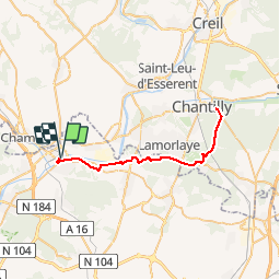
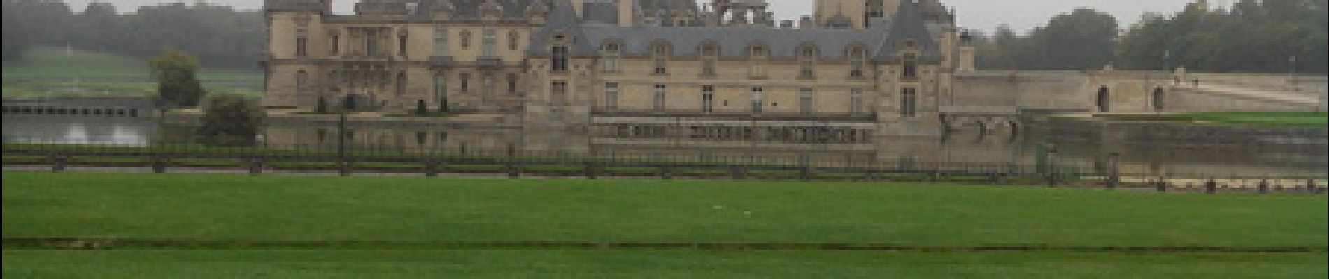
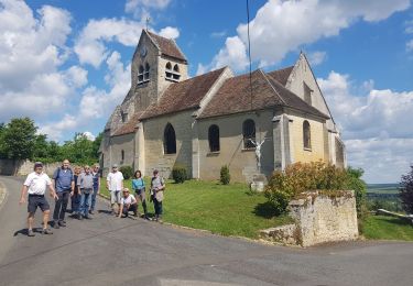
Aller-retour de Persan vers le Château de Chantilly. Pas de difficultés particulières sur cette randonnée qui passe par l'Abbaye de Royaumont, le château de la Reine Blanche prés de l’étang de la Loge avant d'arriver au château de Chantilly. Vous avez la possibilité de faire une petite boucle supplémentaire autour du Champ de Course de l'hippodrome de Chantilly.

Elevation profile

Photos

Positioning

Country:
France
Region :
Ile-de-France
Department/Province :
Val-d'Oise
Municipality :
Persan
Location:
Unknown
Start:(Dec)
Start:(UTM)
448188 ; 5444342 (31U) N.

Trails nearby

Trail Walking Presles - autour de Presles - Photo
Walking
laurentbernardbrunel

Walking

Easy
(2)
Presles, Ile-de-France, Val-d'Oise, France
9 km | 10.4 km-effort
1h 48min
Yes
Trail Walking Beaumont-sur-Oise - Rando Beaumont-Carnelle - Photo
Walking
bobydu60

Walking

Medium
(2)
Beaumont-sur-Oise, Ile-de-France, Val-d'Oise, France
12.9 km | 16.4 km-effort
3h 31min
Yes
Trail Walking Champagne-sur-Oise - Vaux Chateaude Chambly  Ronquerole - Photo
Walking
avdem

Walking

Easy
Champagne-sur-Oise, Ile-de-France, Val-d'Oise, France
10.6 km | 13.1 km-effort
2h 28min
Yes
Trail Walking Beaumont-sur-Oise - Beaumont Noisy Asnieres - Photo
Walking
avdem

Walking

Medium
Beaumont-sur-Oise, Ile-de-France, Val-d'Oise, France
13.2 km | 15.2 km-effort
2h 59min
Yes
Trail Walking Beaumont-sur-Oise - Beaumont sur oise Noisy sur oise - Photo
Walking
avdem

Walking

Easy
Beaumont-sur-Oise, Ile-de-France, Val-d'Oise, France
11.6 km | 15.6 km-effort
2h 46min
Yes
Trail Walking Chambly - Chambly - Photo
Walking
avdem

Walking

Easy
Chambly, Hauts-de-France, Oise, France
17 km | 19.3 km-effort
2h 29min
No
Trail Walking L'Isle-Adam - L,'Isle Adam   Cassin - Photo
Walking
avdem

Walking

Medium
L'Isle-Adam, Ile-de-France, Val-d'Oise, France
7.4 km | 8.5 km-effort
1h 49min
Yes
Trail Walking Ronquerolles - Ronquerolle Messelan Houdan - Photo
Walking
avdem

Walking

Difficult
Ronquerolles, Ile-de-France, Val-d'Oise, France
12.7 km | 16.3 km-effort
2h 57min
Yes
Trail Walking Chambly - Chambly Gabdicourt, Ronquerole - Photo
Walking
avdem

Walking

Medium
Chambly, Hauts-de-France, Oise, France
8.9 km | 10.1 km-effort
2h 5min
No


Close
My subscriptions