Trail Snowshoes Beaucens - Le Pic du Mont - Hautacam - Photo

Le Pic du Mont - Hautacam

 tracegps
tracegps

User

© OpenStreetMap contributors
Length
Length
8.7 km
Max alt
Max alt
1993 m
Uphill gradient
Uphill gradient
516 m
Km-Effort
Km-Effort  
15.6 km
Min alt
Min alt
1590 m
Downhill gradient
Downhill gradient
515 m
Boucle
Boucle
Yes
Creation date :
2014-12-10 00:00:00.0
Updated on :
2014-12-10 00:00:00.0

(0 Reviews)

Snowshoes
Snowshoes
5h10
Difficulty : Medium

Scan this QR Code to open this trail in the SityTrail application

FREE GPS app for hiking

Logo SityTrail SityTrail

IGN / Geographical institutes

Download SityTrail from the App Store Download SityTrail from Google Play

Logo SityTrail SityTrail World

The world is yours!

Download SityTrail from the App Store Download SityTrail from Google Play Download SityTrail on Huawei AppGallery

About

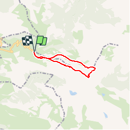
Trail Snowshoes of 8.7 km to be discovered at Occitania, Hautespyrenees, Beaucens. This trail is proposed by tracegps.

Description

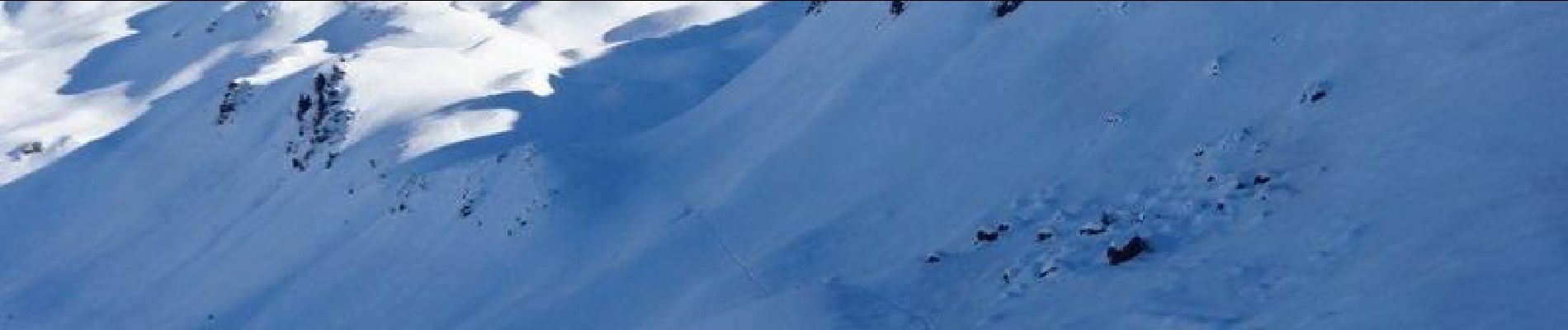
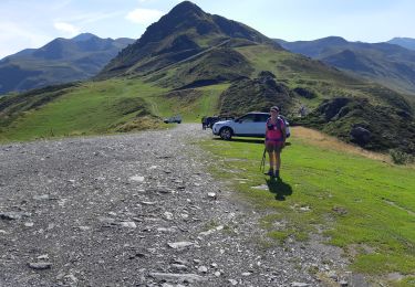
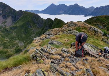
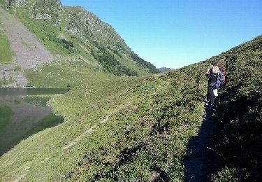
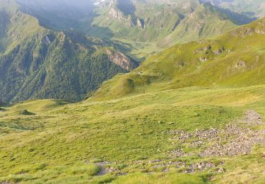
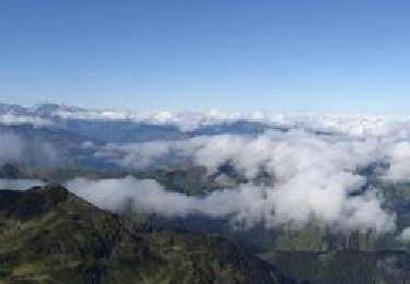
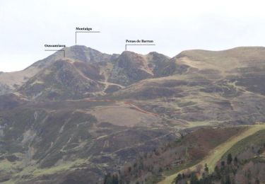
Départ du parking de Tramassel à la station de Hautacam. On monte tout d'abord au col de Moulata, puis on chemine au sud du Pic de Naouit. Après un dévers important on aboutit au Pic de Barran (1982 m). Petite descente puis montée au Pic du Mont à 2003 m. Descente schuss vers le vallon de Naouit, puis remontée vers la Moulata en passant au nord et au pied du Naouit. Très belle randonnée avec de superbes vues au sommet sur toute la chaîne enneigée.

Elevation profile

Photos

Positioning

Country:
France
Region :
Occitania
Department/Province :
Hautespyrenees
Municipality :
Beaucens
Location:
Unknown
Start:(UTM)
744400 ; 4762046 (30T) N.

Trails nearby

Trail Walking Beaucens - Lac d'Ourrec depuis Hautacam - Photo
Walking
611686735

Walking

Easy
(1)
Beaucens, Occitania, Hautespyrenees, France
13 km | 20 km-effort
4h 15min
Yes
Trail Walking Gazost - Pic de Montaigu par le Col de Moulata - Photo
Walking
tracegps

Walking

Very difficult
(1)
Gazost, Occitania, Hautespyrenees, France
7 km | 14.8 km-effort
3h 0min
No
Trail Walking Beaucens - HAUTACAM lac dets plagnous
Walking
GUIDE
marmotte65

Walking

Medium
Beaucens, Occitania, Hautespyrenees, France
7.8 km | 10.9 km-effort
2h 28min
Yes
Trail Walking Beaucens - 2019-07-31_15h54m36_20190731065058-08125-data - Photo
Walking
GUIDE
harydh

Walking

Difficult
Beaucens, Occitania, Hautespyrenees, France
10.1 km | 16.9 km-effort
3h 27min
Yes
Trail Walking Beaucens - soum de lascours aléas bis - Photo
Walking
GUIDE
harydh

Walking

Medium
Beaucens, Occitania, Hautespyrenees, France
18 km | 33 km-effort
5h 55min
Yes
Trail Walking Beaucens - Retour voiture 28 juin 2023 hautacam - Photo
Walking
GUIDE
harydh

Walking

Easy
Beaucens, Occitania, Hautespyrenees, France
3.9 km | 5.3 km-effort
1h 41min
No
Trail Walking Beaucens - Le Pic de Montaigu par les crêtes - Beaucens  - Photo
Walking
tracegps

Walking

Difficult
Beaucens, Occitania, Hautespyrenees, France
14.4 km | 24 km-effort
6h 30min
Yes
Trail Snowshoes Beaucens - hautacam - Photo
Snowshoes
vincentpascal31

Snowshoes

Difficult
Beaucens, Occitania, Hautespyrenees, France
14.2 km | 24 km-effort
6h 8min
Yes
Trail Walking Beaucens - Crête de Penas de Barran - Hautacam - Photo
Walking
tracegps

Walking

Difficult
Beaucens, Occitania, Hautespyrenees, France
13.6 km | 24 km-effort
6h 0min
Yes


Close
My subscriptions