Trail Mountain bike Lamoura - Lac de Lamoura en VTT - Photo

Lac de Lamoura en VTT

 tracegps
tracegps

User

© OpenStreetMap contributors
Length
Length
3.5 km
Max alt
Max alt
1193 m
Uphill gradient
Uphill gradient
76 m
Km-Effort
Km-Effort  
4.5 km
Min alt
Min alt
1148 m
Downhill gradient
Downhill gradient
75 m
Boucle
Boucle
Yes
Creation date :
2014-12-10 00:00:00.0
Updated on :
2014-12-10 00:00:00.0

(0 Reviews)

Mountain bike
Mountain bike
19m
Difficulty : Easy

Scan this QR Code to open this trail in the SityTrail application

FREE GPS app for hiking

Logo SityTrail SityTrail

IGN / Geographical institutes

Download SityTrail from the App Store Download SityTrail from Google Play

Logo SityTrail SityTrail World

The world is yours!

Download SityTrail from the App Store Download SityTrail from Google Play Download SityTrail on Huawei AppGallery

About

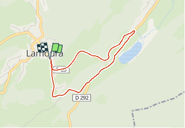
Trail Mountain bike of 3.5 km to be discovered at Bourgogne-Franche-Comté, Jura, Lamoura. This trail is proposed by tracegps.

Description

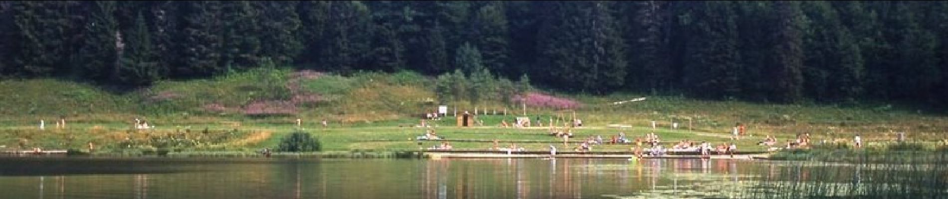
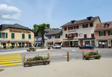
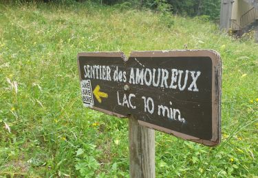
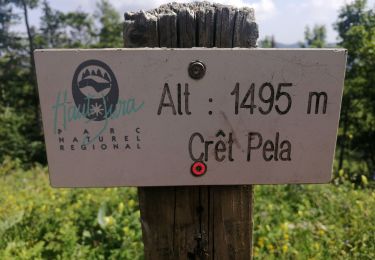
1 - Depuis l’Office de tourisme de Lamoura, suivez en direction des Rousses la Grande Rue. Passez devant l’hôtel La Spatule et continuez tout droit pour emprunter la route de Lajoux qui monte progressivement. 2 - Au carrefour dirigez-vous tout droit en direction du lac. Le grand champ à votre droite est le célèbre départ de la Transjurassienne, une course de ski de fond internationale qui relie Lamoura à Mouthe (76km). Prenez le temps d’apprécier le site du lac de Lamoura. Vous pouvez faire le tour du lac à pied, accéder par le platelage à sa tourbière puis monter jusqu’au belvédère au-dessus du lac. Poursuivez votre circuit en empruntant toujours la route du lac jusqu’au carrefour. 3 - Prenez ensuite la RD25 à gauche pour retourner au centre de Lamoura. La route monte puis redescend au village. Départ : Office de tourisme de Lamoura Distance : 3,5km Dénivelés : 55m Temps : 20min Difficulté : très facile en VTC et très facile en VAE Terrain : route goudronnée

Elevation profile

Photos

Positioning

Country:
France
Region :
Bourgogne-Franche-Comté
Department/Province :
Jura
Municipality :
Lamoura
Location:
Unknown
Start:(Dec)
Start:(UTM)
728166 ; 5142143 (31T) N.

Trails nearby

Trail Walking Septmoncel les Molunes - circuit des chamois Septmoncel  - Photo
Walking
zoe.vienne

Walking

Difficult
(1)
Septmoncel les Molunes, Bourgogne-Franche-Comté, Jura, France
16.3 km | 31 km-effort
5h 51min
Yes
Trail Walking Lamoura - Tresberruy - Lamoura - Photo
Walking
tracegps

Walking

Difficult
(1)
Lamoura, Bourgogne-Franche-Comté, Jura, France
14.5 km | 20 km-effort
4h 0min
Yes
Trail Cycle Lajoux - 2023-08-18_15h23m20_lamoura - Photo
Cycle
daniellebou

Cycle

Very easy
(1)
Lajoux, Bourgogne-Franche-Comté, Jura, France
21 km | 26 km-effort
Unknown
Yes
Trail Running Mijoux - UTTJ 2015-2 - Photo
Running
bourel.jacques

Running

Very difficult
(1)
Mijoux, Auvergne-Rhône-Alpes, Ain, France
57 km | 92 km-effort
18h 13min
No
Trail Walking Gex - Balade à Col de la Faucille, Gex - Photo
Walking
Gaiato

Walking

Very difficult
Gex, Auvergne-Rhône-Alpes, Ain, France
86 km | 135 km-effort
9h 23min
No
Trail Bicycle tourism Mijoux - LES ROUSSES - COL DE LA FAUCILLE  - Photo
Bicycle tourism
jean-marie.parachini

Bicycle tourism

Very difficult
Mijoux, Auvergne-Rhône-Alpes, Ain, France
54 km | 68 km-effort
4h 57min
No
Trail Walking Lamoura - Autour Lamoura - Photo
Walking
swp648

Walking

Medium
Lamoura, Bourgogne-Franche-Comté, Jura, France
17.1 km | 25 km-effort
4h 37min
Yes
Trail Walking Lamoura - Le Crêt Pela - Photo
Walking
Le jurassien

Walking

Medium
Lamoura, Bourgogne-Franche-Comté, Jura, France
21 km | 28 km-effort
5h 37min
Yes
Trail Snowshoes Lamoura - Lamoura 14km D+ 493 20210228 - Photo
Snowshoes
cmike39

Snowshoes

Very easy
Lamoura, Bourgogne-Franche-Comté, Jura, France
14 km | 21 km-effort
3h 36min
Yes


Close
My subscriptions