


la pointe des Ratissières \ col de l'épaisseur

laurentnecca
User
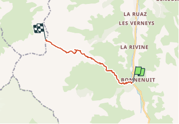

Length
8.3 km

Max alt
2909 m

Uphill gradient
1374 m
Km-Effort
23 km

Min alt
1692 m

Downhill gradient
165 m
Boucle
No
Creation date :
2022-03-20 06:17:38.816
Updated on :
2022-03-21 13:53:56.283
4h27
Difficulty : Difficult

FREE GPS app for hiking
 SityTrail
IGN / Geographical institutes
SityTrail Plus
The world is yours!
About
Trail Touring skiing of 8.3 km to be discovered at Auvergne-Rhône-Alpes, Savoy, Valloire. This trail is proposed by laurentnecca.
Positioning
Country:
France
Region :
Auvergne-Rhône-Alpes
Department/Province :
Savoy
Municipality :
Valloire
Location:
Unknown
Start:(Dec)
Start:(UTM)
296937 ; 4999458 (32T) N.
Comments