


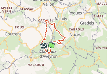

11.3 km | 16 km-effort


User


FREE GPS app for hiking
 SityTrail
IGN / Geographical institutes
SityTrail World
The world is yours!
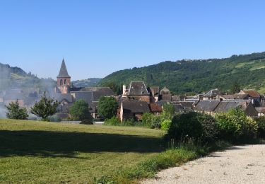
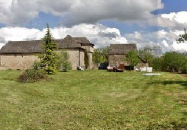
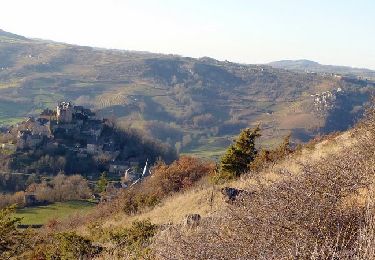
Trail Walking of 11.7 km to be discovered at Occitania, Aveyron, Clairvaux-d'Aveyron. This trail is proposed by ZITO12.
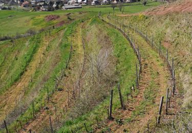
Rando dans les vignes du Marcillac la plupart du temps chemins dominant avec de belles vues. Le jour de l'enregistrement le temps était couvert. Par soleil c'est magnifique.


On foot
On foot
On foot
Walking
Walking
Walking

Walking
Walking

Walking