


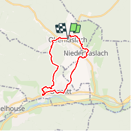

14.9 km | 21 km-effort


User


FREE GPS app for hiking
 SityTrail
IGN / Geographical institutes
SityTrail World
The world is yours!
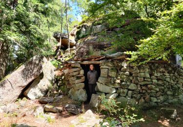
Trail Walking of 10.4 km to be discovered at Grand Est, Bas-Rhin, Oberhaslach. This trail is proposed by tracegps.
Circuit pédestre de 3h à la découverte des croix et calvaire des 3 villages de moyenne montagne. Départ de la mairie de Oberhaslach ou de Niederhaslach.


Walking

Horseback riding

Walking

Mountain bike

Mountain bike
Walking
Horseback riding
Horseback riding
Horseback riding