Trail Walking Moncaut - Balade sur le mont chauve - Moncaut - Photo

Balade sur le mont chauve - Moncaut

 tracegps
tracegps

User

© OpenStreetMap contributors
Length
Length
4.3 km
Max alt
Max alt
203 m
Uphill gradient
Uphill gradient
104 m
Km-Effort
Km-Effort  
5.7 km
Min alt
Min alt
118 m
Downhill gradient
Downhill gradient
109 m
Boucle
Boucle
Yes
Creation date :
2014-12-10 00:00:00.0
Updated on :
2014-12-10 00:00:00.0

(0 Reviews)

Walking
Walking
1h30
Difficulty : Easy

Scan this QR Code to open this trail in the SityTrail application

FREE GPS app for hiking

Logo SityTrail SityTrail

IGN / Geographical institutes

Download SityTrail from the App Store Download SityTrail from Google Play

Logo SityTrail SityTrail World

The world is yours!

Download SityTrail from the App Store Download SityTrail from Google Play Download SityTrail on Huawei AppGallery

About

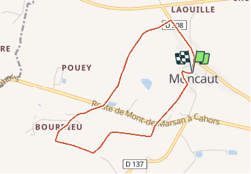
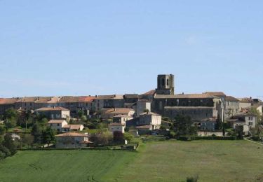
Trail Walking of 4.3 km to be discovered at New Aquitaine, Lot-et-Garonne, Moncaut. This trail is proposed by tracegps.

Description

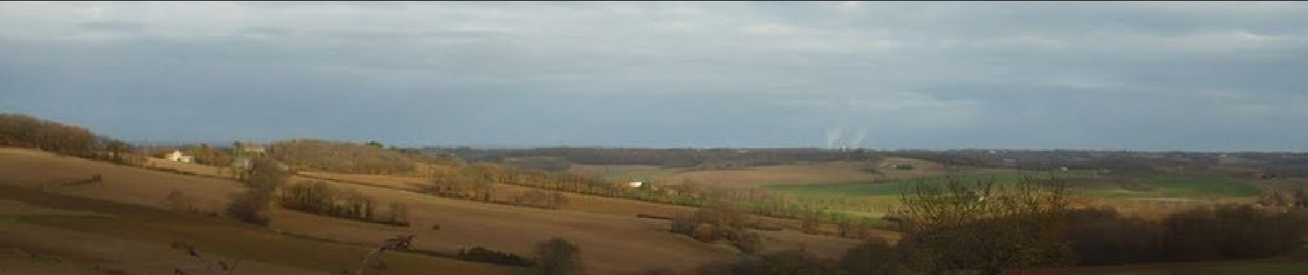
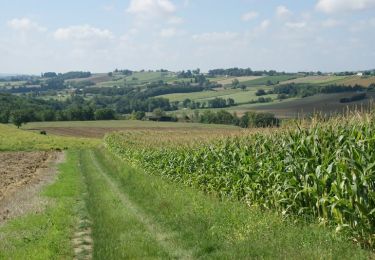
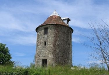
Cette colline au sommet bien dégagé est habitée depuis longtemps. Ceux qui s’y installent aujourd’hui retrouvent les mêmes points de vue, vers Montagnac, Laplume, les coteaux d’Albret et les Pyrénées. Départ de la place de l’église. Téléchargez la fiche de cette randonnée sur le site du Tourisme du Lot et Garonne.

Elevation profile

Photos

Positioning

Country:
France
Region :
New Aquitaine
Department/Province :
Lot-et-Garonne
Municipality :
Moncaut
Location:
Unknown
Start:(UTM)
299913 ; 4890657 (31T) N.

Trails nearby

Trail Equestrian Montagnac-sur-Auvignon - Petite montagne d'Albret - Montagnac sur Auvignon  - Photo
Equestrian
tracegps

Equestrian

Easy
Montagnac-sur-Auvignon, New Aquitaine, Lot-et-Garonne, France
7.3 km | 10 km-effort
1h 15min
Yes
Trail Mountain bike Montagnac-sur-Auvignon - Petite montagne d'Albret - Montagnac sur Auvignon  - Photo
Mountain bike
tracegps

Mountain bike

Easy
Montagnac-sur-Auvignon, New Aquitaine, Lot-et-Garonne, France
7.3 km | 10 km-effort
55min
Yes
Trail Walking Montagnac-sur-Auvignon - Petite montagne d'Albret - Montagnac sur Auvignon  - Photo
Walking
tracegps

Walking

Medium
Montagnac-sur-Auvignon, New Aquitaine, Lot-et-Garonne, France
7.3 km | 10 km-effort
2h 30min
Yes
Trail Mountain bike Saumont - Le Saumont vers Montagnac, par les Grand et Petit Auvignon - Photo
Mountain bike
tracegps

Mountain bike

Medium
Saumont, New Aquitaine, Lot-et-Garonne, France
15.1 km | 19.6 km-effort
1h 49min
Yes
Trail Walking Saumont - Le Saumont vers Montagnac, par les Grand et Petit Auvignon - Photo
Walking
tracegps

Walking

Difficult
Saumont, New Aquitaine, Lot-et-Garonne, France
15.1 km | 19.6 km-effort
3h 49min
Yes
Trail Mountain bike Saumont - Le Saumont, randonnée autour du mont boisé - Photo
Mountain bike
tracegps

Mountain bike

Medium
Saumont, New Aquitaine, Lot-et-Garonne, France
14.1 km | 18.3 km-effort
1h 45min
Yes
Trail Walking Saumont - Le Saumont, randonnée autour du mont boisé - Photo
Walking
tracegps

Walking

Difficult
Saumont, New Aquitaine, Lot-et-Garonne, France
14.1 km | 18.3 km-effort
3h 34min
Yes
Trail Walking Laplume - Laplume, le circuit des trois lavoirs - Pays de l'Agenais - Photo
Walking
tracegps

Walking

Medium
Laplume, New Aquitaine, Lot-et-Garonne, France
5.1 km | 7.1 km-effort
1h 30min
Yes
Trail On foot Montagnac-sur-Auvignon - Montagnac, petite montagne d'Albret 7.4 km - Photo
On foot
PRO

On foot

Easy
Montagnac-sur-Auvignon, New Aquitaine, Lot-et-Garonne, France
7.5 km | 10.1 km-effort
2h 18min
Yes


Close
My subscriptions