


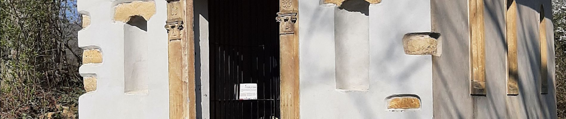
68 Rouffach -Schauenberg

E.BURCK
User
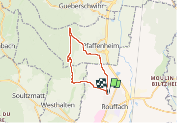

Length
11 km

Max alt
507 m

Uphill gradient
389 m
Km-Effort
16.2 km

Min alt
210 m

Downhill gradient
390 m
Boucle
Yes
Creation date :
2022-03-24 08:14:19.41
Updated on :
2022-05-03 07:21:10.329
3h33
Difficulty : Medium

FREE GPS app for hiking
 SityTrail
IGN / Geographical institutes
SityTrail Plus
The world is yours!
About
Trail Walking of 11 km to be discovered at Grand Est, Haut-Rhin, Rouffach. This trail is proposed by E.BURCK.
Photos


Positioning
Country:
France
Region :
Grand Est
Department/Province :
Haut-Rhin
Municipality :
Rouffach
Location:
Unknown
Start:(Dec)
Start:(UTM)
372733 ; 5313578 (32T) N.
Comments