Trail Walking Ladignac-sur-Rondelles - Argeassou, Rondelle et Avalouze - Ladignac sur Rondelles - Pays de Tulle - Photo

Argeassou, Rondelle et Avalouze - Ladignac sur Rondelles - Pays de Tulle

 tracegps
tracegps

User

© OpenStreetMap contributors
Length
Length
6.6 km
Max alt
Max alt
470 m
Uphill gradient
Uphill gradient
239 m
Km-Effort
Km-Effort  
9.7 km
Min alt
Min alt
329 m
Downhill gradient
Downhill gradient
239 m
Boucle
Boucle
Yes
Creation date :
2014-12-10 00:00:00.0
Updated on :
2014-12-10 00:00:00.0

(1 Reviews)

Walking
Walking
2h00
Difficulty : Medium

Scan this QR Code to open this trail in the SityTrail application

FREE GPS app for hiking

Logo SityTrail SityTrail

IGN / Geographical institutes

Download SityTrail from the App Store Download SityTrail from Google Play

Logo SityTrail SityTrail World

The world is yours!

Download SityTrail from the App Store Download SityTrail from Google Play Download SityTrail on Huawei AppGallery

About

Trail Walking of 6.6 km to be discovered at New Aquitaine, Corrèze, Ladignac-sur-Rondelles. This trail is proposed by tracegps.

Description

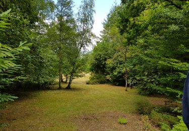
A l'est du bourg situé entre deux vallons, où sillonne ce circuit, le plateau est tranché par le ruisseau de la Rondelle qui reçoit l'Argeassou avant de rejoindre la Saint-Bonnette, (appelée aussi localement Avalouze !)... Versants boisés, fonds herbeux, les villages s'étirent sur les sommets longilignes. Un muret en pierres sèches vous conduira auprès d'une jolie église du XIIème siècle marqué d'un traditionnel clocher-mur. Face à elle, une croix calcaire du XIVème siècle présente plusieurs scènes finement ciselées. Téléchargez la fiche du circuit sur le site du Tourisme en Limousin.

Elevation profile

Photos

Positioning

Country:
France
Region :
New Aquitaine
Department/Province :
Corrèze
Municipality :
Ladignac-sur-Rondelles
Location:
Unknown
Start:(Dec)
Start:(UTM)
408985 ; 5009420 (31T) N.

Comments

Please log in to post a review or rate the element


Trails nearby

Trail Mountain bike Espagnac - vtt Adrien Antoine et Bert - Photo
Mountain bike
bcarpentier

Mountain bike

Medium
(1)
Espagnac, New Aquitaine, Corrèze, France
26 km | 34 km-effort
3h 9min
Yes
Trail Walking Laguenne-sur-Avalouze - Laguenne Chemin des Puys - Photo
Walking
houbart

Walking

Medium
(1)
Laguenne-sur-Avalouze, New Aquitaine, Corrèze, France
9.5 km | 14.1 km-effort
3h 2min
Yes
Trail Walking Laguenne-sur-Avalouze - Camping le pre du moulin - Photo
Walking
Geronimo2010

Walking

Easy
(1)
Laguenne-sur-Avalouze, New Aquitaine, Corrèze, France
4.9 km | 6.5 km-effort
1h 4min
Yes
Trail Walking Espagnac - 20200809 balade transco - Photo
Walking
bcarpentier

Walking

Medium
Espagnac, New Aquitaine, Corrèze, France
8.9 km | 12.3 km-effort
3h 39min
Yes
Trail Mountain bike Saint-Martial-de-Gimel - 20190822 GAAB 25 km - Photo
Mountain bike
bcarpentier

Mountain bike

Difficult
Saint-Martial-de-Gimel, New Aquitaine, Corrèze, France
17.4 km | 22 km-effort
2h 6min
No
Trail 4x4 Saint-Martial-de-Gimel - embourbé  - Photo
4x4
Jérémy Cheze

4x4

Very easy
Saint-Martial-de-Gimel, New Aquitaine, Corrèze, France
84 km | 111 km-effort
6h 21min
No
Trail Road bike Espagnac - Balade du dimanche 47 km - Photo
Road bike
bcarpentier

Road bike

Medium
Espagnac, New Aquitaine, Corrèze, France
46 km | 57 km-effort
3h 19min
Yes
Trail Walking Espagnac - Balade de reprise  - Photo
Walking
bcarpentier

Walking

Easy
Espagnac, New Aquitaine, Corrèze, France
6.8 km | 9.5 km-effort
2h 7min
Yes
Trail Trail Espagnac - 20200808 trail transco 17.5K 500D - Photo
Trail
bcarpentier

Trail

Difficult
Espagnac, New Aquitaine, Corrèze, France
17.6 km | 24 km-effort
2h 18min
Yes


Close
My subscriptions