


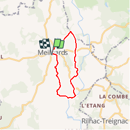

9.7 km | 12.3 km-effort

User


FREE GPS app for hiking
 SityTrail
IGN / Geographical institutes
SityTrail World
The world is yours!
Trail Walking of 9.7 km to be discovered at New Aquitaine, Corrèze, Meilhards. This trail is proposed by tracegps.
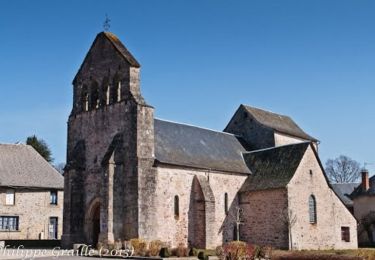
Partant de l'église, en admirant nos dernières sculptures, vous pourrez apprécier, par de beaux chemins ombragés, le charme de notre campagne. Des chemins de crête d'où l'on découvre les puys environnants, jusqu'aux vallons ou courent les ruisseaux, vous marcherez sur les routes de pouge, déjà utilisées au début de l'ère chrétienne. Vous profiterez de la quiétude, de l'air vif et pur et des très nombreux feuillus qui jalonneront votre parcours. Avec un peu de chance, à la saison, vous cueillerez quelques champignons. Téléchargez la fiche du circuit sur le site du Tourisme en Limousin.


Walking

Walking
Walking

Cycle
Cycle
Cycle
Cycle
Cycle
Cycle