


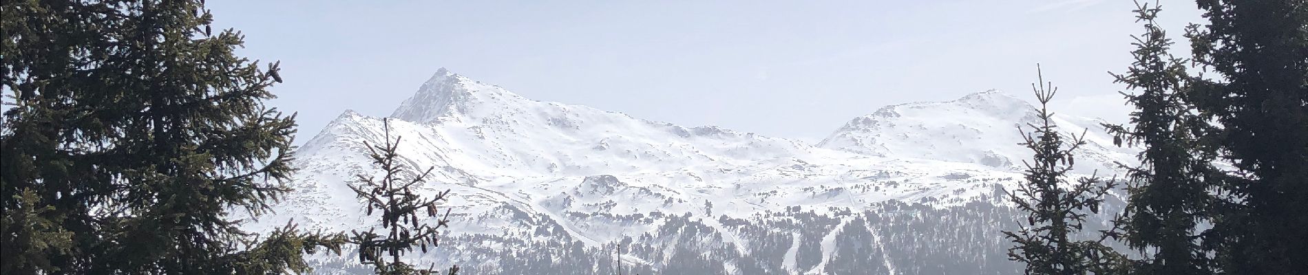
Termignon - la Turra

yves12
User
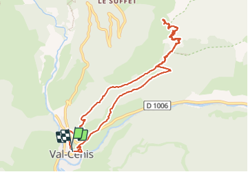

Length
12 km

Max alt
2318 m

Uphill gradient
1018 m
Km-Effort
26 km

Min alt
1301 m

Downhill gradient
1019 m
Boucle
Yes
Creation date :
2022-03-29 09:45:18.0
Updated on :
2022-03-29 17:21:20.324
6h27
Difficulty : Medium

FREE GPS app for hiking
 SityTrail
IGN / Geographical institutes
SityTrail Plus
The world is yours!
About
Trail Walking of 12 km to be discovered at Auvergne-Rhône-Alpes, Savoy, Val-Cenis. This trail is proposed by yves12.
Photos


Positioning
Country:
France
Region :
Auvergne-Rhône-Alpes
Department/Province :
Savoy
Municipality :
Val-Cenis
Location:
Termignon
Start:(Dec)
Start:(UTM)
328786 ; 5016110 (32T) N.
Comments