


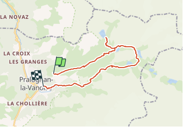
lac de la patinoire et col de Vanoise

geoffrayLayeux
User

Length
14.9 km

Max alt
2517 m

Uphill gradient
797 m
Km-Effort
27 km

Min alt
1464 m

Downhill gradient
1297 m
Boucle
No
Creation date :
2022-03-31 15:45:51.455
Updated on :
2022-03-31 15:45:54.534
6h10
Difficulty : Very difficult

FREE GPS app for hiking
 SityTrail
IGN / Geographical institutes
SityTrail Plus
The world is yours!
About
Trail Walking of 14.9 km to be discovered at Auvergne-Rhône-Alpes, Savoy, Pralognan-la-Vanoise. This trail is proposed by geoffrayLayeux.
Positioning
Country:
France
Region :
Auvergne-Rhône-Alpes
Department/Province :
Savoy
Municipality :
Pralognan-la-Vanoise
Location:
Unknown
Start:(Dec)
Start:(UTM)
322546 ; 5028399 (32T) N.
Comments