


aavm treh/1

jcguew
User
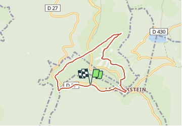

Length
6.6 km

Max alt
1212 m

Uphill gradient
167 m
Km-Effort
8.9 km

Min alt
1124 m

Downhill gradient
172 m
Boucle
Yes
Creation date :
2022-04-08 15:58:49.623
Updated on :
2022-04-08 15:58:50.046
2h00
Difficulty : Easy

FREE GPS app for hiking
 SityTrail
IGN / Geographical institutes
SityTrail Plus
The world is yours!
About
Trail Walking of 6.6 km to be discovered at Grand Est, Haut-Rhin, Ranspach. This trail is proposed by jcguew.
Description
tour du Trehkopf
Positioning
Country:
France
Region :
Grand Est
Department/Province :
Haut-Rhin
Municipality :
Ranspach
Location:
Unknown
Start:(Dec)
Start:(UTM)
352084 ; 5309788 (32T) N.
Comments