


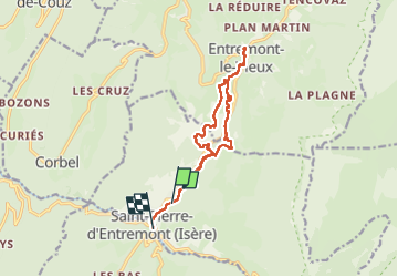

14.4 km | 27 km-effort


User


FREE GPS app for hiking
 SityTrail
IGN / Geographical institutes
SityTrail World
The world is yours!
Trail Walking of 14.5 km to be discovered at Auvergne-Rhône-Alpes, Savoy, Saint-Pierre-d'Entremont. This trail is proposed by Valgaudemar.
Rando facile, le long du Cozon, en boucle partielle.


Walking

Snowshoes

Walking

Walking

Snowshoes

Walking

Walking

Walking

Walking
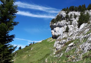
Belles photos !