


col de fouchy, col de la hingrie

gamille67
User
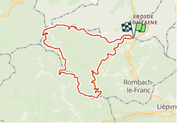

Length
21 km

Max alt
845 m

Uphill gradient
807 m
Km-Effort
31 km

Min alt
371 m

Downhill gradient
799 m
Boucle
Yes
Creation date :
2022-04-18 09:21:22.933
Updated on :
2022-04-18 15:55:23.451
4h36
Difficulty : Medium

FREE GPS app for hiking
 SityTrail
IGN / Geographical institutes
SityTrail Plus
The world is yours!
About
Trail Walking of 21 km to be discovered at Grand Est, Haut-Rhin, Rombach-le-Franc. This trail is proposed by gamille67.
Positioning
Country:
France
Region :
Grand Est
Department/Province :
Haut-Rhin
Municipality :
Rombach-le-Franc
Location:
Unknown
Start:(Dec)
Start:(UTM)
370954 ; 5351629 (32U) N.
Comments