


moosch

danif
User
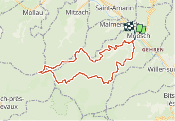

Length
18.5 km

Max alt
1043 m

Uphill gradient
918 m
Km-Effort
31 km

Min alt
385 m

Downhill gradient
926 m
Boucle
Yes
Creation date :
2022-04-21 07:39:49.745
Updated on :
2022-04-21 14:51:39.475
5h10
Difficulty : Very difficult

FREE GPS app for hiking
 SityTrail
IGN / Geographical institutes
SityTrail Plus
The world is yours!
About
Trail Walking of 18.5 km to be discovered at Grand Est, Haut-Rhin, Moosch. This trail is proposed by danif.
Positioning
Country:
France
Region :
Grand Est
Department/Province :
Haut-Rhin
Municipality :
Moosch
Location:
Unknown
Start:(Dec)
Start:(UTM)
353816 ; 5302321 (32T) N.
Comments