


SOUS LE TRELOD

djeepee74
User
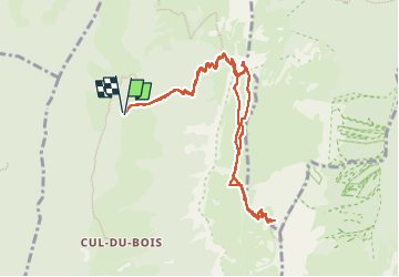

Length
11 km

Max alt
2094 m

Uphill gradient
1070 m
Km-Effort
25 km

Min alt
1206 m

Downhill gradient
1068 m
Boucle
Yes
Creation date :
2022-05-01 07:18:09.19
Updated on :
2022-05-03 14:02:20.669
4h10
Difficulty : Very difficult

FREE GPS app for hiking
 SityTrail
IGN / Geographical institutes
SityTrail Plus
The world is yours!
About
Trail Walking of 11 km to be discovered at Auvergne-Rhône-Alpes, Savoy, Doucy-en-Bauges. This trail is proposed by djeepee74.
Description
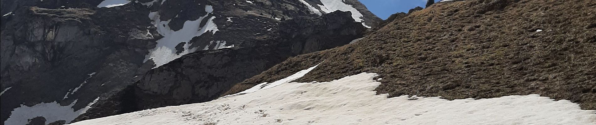
BOUCLE... live de Cris & Karine and Co le 20220501
... Le sommet n'a pas été atteint pour cause d'enneigement délicat !
Photos


Positioning
Country:
France
Region :
Auvergne-Rhône-Alpes
Department/Province :
Savoy
Municipality :
Doucy-en-Bauges
Location:
Unknown
Start:(Dec)
Start:(UTM)
279868 ; 5065222 (32T) N.
Comments