


BF LIVE DIMANCHE 8 MAI

claude nier
User
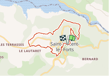

Length
9.5 km

Max alt
1273 m

Uphill gradient
376 m
Km-Effort
14.5 km

Min alt
947 m

Downhill gradient
377 m
Boucle
Yes
Creation date :
2022-05-08 06:25:08.51
Updated on :
2022-05-09 08:31:34.119
5h27
Difficulty : Difficult

FREE GPS app for hiking
 SityTrail
IGN / Geographical institutes
SityTrail Plus
The world is yours!
About
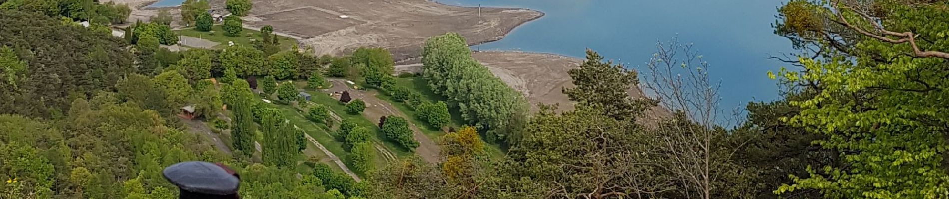
Trail Walking of 9.5 km to be discovered at Provence-Alpes-Côte d'Azur, Alpes-de-Haute-Provence, Ubaye-Serre-Ponçon. This trail is proposed by claude nier.
Photos

Positioning
Country:
France
Region :
Provence-Alpes-Côte d'Azur
Department/Province :
Alpes-de-Haute-Provence
Municipality :
Ubaye-Serre-Ponçon
Location:
Unknown
Start:(Dec)
Start:(UTM)
291070 ; 4924596 (32T) N.
Comments