


KV Sollière l'endroit

mikaelerouzic
User
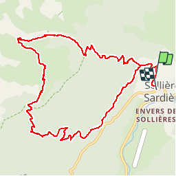

Length
12.1 km

Max alt
2372 m

Uphill gradient
1070 m
Km-Effort
26 km

Min alt
1313 m

Downhill gradient
1110 m
Boucle
No
Creation date :
2014-12-10 00:00:00.0
Updated on :
2014-12-10 00:00:00.0
1h30
Difficulty : Very difficult

FREE GPS app for hiking
 SityTrail
IGN / Geographical institutes
SityTrail Plus
The world is yours!
About
Trail Running of 12.1 km to be discovered at Auvergne-Rhône-Alpes, Savoy, Val-Cenis. This trail is proposed by mikaelerouzic.


Positioning
Country:
France
Region :
Auvergne-Rhône-Alpes
Department/Province :
Savoy
Municipality :
Val-Cenis
Location:
Sollières-Sardières
Start:(Dec)
Start:(UTM)
327834 ; 5014953 (32T) N.
Comments