


Tour de Fréland

duchaine.nicolas
User
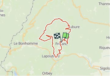

Length
28 km

Max alt
1143 m

Uphill gradient
871 m
Km-Effort
39 km

Min alt
424 m

Downhill gradient
863 m
Boucle
Yes
Creation date :
2022-05-14 07:52:02.653
Updated on :
2022-05-14 09:46:16.521
1h53
Difficulty : Easy
1h53
Difficulty : Easy

FREE GPS app for hiking
 SityTrail
IGN / Geographical institutes
SityTrail Plus
The world is yours!
About
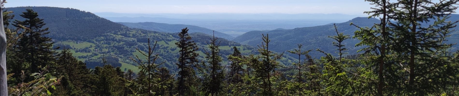
Trail Mountain bike of 28 km to be discovered at Grand Est, Haut-Rhin, Fréland. This trail is proposed by duchaine.nicolas.
Photos

Positioning
Country:
France
Region :
Grand Est
Department/Province :
Haut-Rhin
Municipality :
Fréland
Location:
Unknown
Start:(Dec)
Start:(UTM)
365797 ; 5337179 (32U) N.
Comments