Trail Walking Cevins - Cevins acte 1 - Photo
 bill73
bill73

User

© OpenStreetMap contributors
Length
Length
18.3 km
Max alt
Max alt
2195 m
Uphill gradient
Uphill gradient
1666 m
Km-Effort
Km-Effort  
40 km
Min alt
Min alt
745 m
Downhill gradient
Downhill gradient
1658 m
Boucle
Boucle
Yes
Creation date :
2022-05-15 06:07:04.464
Updated on :
2022-05-15 12:14:50.145

(0 Reviews)

Walking
Walking
5h07
Difficulty : Very difficult

Scan this QR Code to open this trail in the SityTrail application

FREE GPS app for hiking

Logo SityTrail SityTrail

IGN / Geographical institutes

Download SityTrail from the App Store Download SityTrail from Google Play

Logo SityTrail SityTrail World

The world is yours!

Download SityTrail from the App Store Download SityTrail from Google Play Download SityTrail on Huawei AppGallery

About

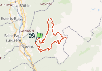
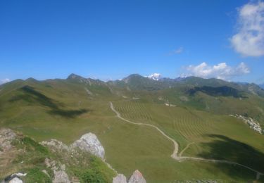
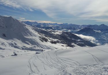
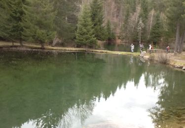
Trail Walking of 18.3 km to be discovered at Auvergne-Rhône-Alpes, Savoy, Cevins. This trail is proposed by bill73.

Description

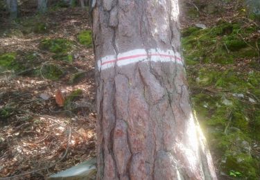
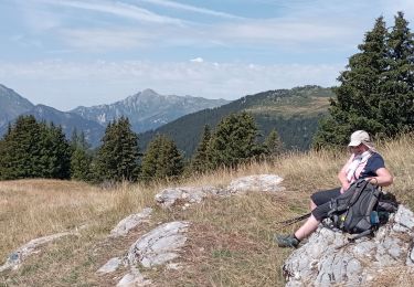
Bonne rando pour commencer à connaître les chemins, monter jusqu'au Col des Evettes.
Vu chamois- Cerf

Elevation profile

Photos

Positioning

Country:
France
Region :
Auvergne-Rhône-Alpes
Department/Province :
Savoy
Municipality :
Cevins
Location:
Unknown
Start:(UTM)
302316 ; 5052072 (32T) N.

Trails nearby

Trail Touring skiing La Léchère - M'ont Bellacha NE par le col de l'arc - Photo
Touring skiing
nadd73

Touring skiing

Difficult
La Léchère, Auvergne-Rhône-Alpes, Savoy, France
14.1 km | 35 km-effort
5h 32min
Yes
Trail Touring skiing La Bâthie - La pointe de Lavouet - Photo
Touring skiing
nadd73

Touring skiing

Medium
La Bâthie, Auvergne-Rhône-Alpes, Savoy, France
16.3 km | 33 km-effort
5h 45min
Yes
Trail Touring skiing Saint-Paul-sur-Isère - la thuile - Photo
Touring skiing
nadd73

Touring skiing

Easy
Saint-Paul-sur-Isère, Auvergne-Rhône-Alpes, Savoy, France
11.4 km | 24 km-effort
5h 42min
Yes
Trail Walking La Léchère - Tour du Quermoz par Grand Naves  - Photo
Walking
zazie

Walking

Medium
La Léchère, Auvergne-Rhône-Alpes, Savoy, France
16 km | 30 km-effort
4h 30min
No
Trail Walking La Léchère - Ronchat La Cudraz Navette Plan des Heures Balcon des Adrets de Tarentaise  - Photo
Walking
zazie

Walking

Difficult
La Léchère, Auvergne-Rhône-Alpes, Savoy, France
8.3 km | 13.7 km-effort
3h 0min
Yes
Trail Walking Cevins - Benettant  - Photo
Walking
oflamment

Walking

Cevins, Auvergne-Rhône-Alpes, Savoy, France
4.3 km | 9.1 km-effort
3h 49min
No
Trail Walking La Léchère - grand naves Beaufortain  - Photo
Walking
BernardAF

Walking

Very difficult
La Léchère, Auvergne-Rhône-Alpes, Savoy, France
12.8 km | 21 km-effort
5h 31min
Yes
Trail Snowshoes La Léchère - Le grand Cretet depuis Grand Naves - Photo
Snowshoes
olivecoco

Snowshoes

Medium
La Léchère, Auvergne-Rhône-Alpes, Savoy, France
94 km | 122 km-effort
5h 0min
No
Trail Walking Esserts-Blay - Esserts-Blay - ch. Gd Arbey - Photo
Walking
Bogapuki

Walking

Easy
Esserts-Blay, Auvergne-Rhône-Alpes, Savoy, France
11.4 km | 17.3 km-effort
3h 51min
Yes


Close
My subscriptions