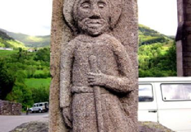
Trail Walking Nieudan - Grand Laveissieres Le Meyniel - Photo

Grand Laveissieres Le Meyniel

© OpenStreetMap contributors
Length
Length
5.2 km
Max alt
Max alt
607 m
Uphill gradient
Uphill gradient
134 m
Km-Effort
Km-Effort  
7 km
Min alt
Min alt
492 m
Downhill gradient
Downhill gradient
134 m
Boucle
Boucle
Yes
Creation date :
2022-05-15 12:01:59.726
Updated on :
2022-05-15 15:09:33.289

(0 Reviews)

Walking
Walking
2h17
Difficulty : Medium

Scan this QR Code to open this trail in the SityTrail application

FREE GPS app for hiking

Logo SityTrail SityTrail

IGN / Geographical institutes

Download SityTrail from the App Store Download SityTrail from Google Play

Logo SityTrail SityTrail World

The world is yours!

Download SityTrail from the App Store Download SityTrail from Google Play Download SityTrail on Huawei AppGallery

About

Trail Walking of 5.2 km to be discovered at Auvergne-Rhône-Alpes, Cantal, Nieudan. This trail is proposed by delzonsgeraud.

Description

Circuit un peu plus long que le tracé Laveissières Le Meyniel. La deuxième partie est un peu plus difficile car il faut marcher dans le bois sans suivre un sentier tracé. La première traversée du ruisseau se fait par un petit pont récemment construit. Pour le deuxième traversée il faut choisir un point facile.

Elevation profile

Positioning

Country:
France
Region :
Auvergne-Rhône-Alpes
Department/Province :
Cantal
Municipality :
Nieudan
Location:
Unknown
Start:(UTM)
439979 ; 4981169 (31T) N.

Trails nearby

Trail Walking Laroquebrou - La Via Arverna (Laroquebrou - Camps-Saint-Mathurin) - Photo
Walking
tracegps

Walking

Difficult
Laroquebrou, Auvergne-Rhône-Alpes, Cantal, France
24 km | 34 km-effort
7h 30min
No
Trail Walking Nieudan - Le Meyrou - Photo
Walking
delzonsgeraud

Walking

Medium
Nieudan, Auvergne-Rhône-Alpes, Cantal, France
6.9 km | 8.7 km-effort
3h 8min
No
Trail Walking Nieudan - Les Garrigues Laveissiere Le Meyniel - Photo
Walking
delzonsgeraud

Walking

Medium
Nieudan, Auvergne-Rhône-Alpes, Cantal, France
5.7 km | 7.8 km-effort
1h 42min
Yes
Trail Walking Nieudan - La Gourgue Cas2 - Photo
Walking
delzonsgeraud

Walking

Medium
Nieudan, Auvergne-Rhône-Alpes, Cantal, France
6.6 km | 9.2 km-effort
2h 56min
Yes
Trail Walking Laroquebrou - Montmiole- Laroquebrou-Puech Mezerie- Gresse- La Margide - Photo
Walking
delzonsgeraud

Walking

Difficult
Laroquebrou, Auvergne-Rhône-Alpes, Cantal, France
10.8 km | 14.4 km-effort
3h 8min
Yes
Trail Walking Nieudan - Le Pont d'Orgon-Peyrelevade-La Siveyrie - Photo
Walking
delzonsgeraud

Walking

Medium
Nieudan, Auvergne-Rhône-Alpes, Cantal, France
6.2 km | 8 km-effort
1h 44min
Yes
Trail Walking Saint-Santin-Cantalès - Cazaret Pruns - Photo
Walking
delzonsgeraud

Walking

Medium
Saint-Santin-Cantalès, Auvergne-Rhône-Alpes, Cantal, France
6.1 km | 8.2 km-effort
2h 3min
Yes
Trail Walking Nieudan - Cas 11 - Photo
Walking
delzonsgeraud

Walking

Medium
Nieudan, Auvergne-Rhône-Alpes, Cantal, France
7.3 km | 9.5 km-effort
2h 24min
Yes
Trail Walking Nieudan - au bord du ruisseau de Conne - Photo
Walking
delzonsgeraud

Walking

Easy
Nieudan, Auvergne-Rhône-Alpes, Cantal, France
4 km | 5.3 km-effort
1h 29min
Yes


Close
My subscriptions