


Ardin

reva17
User
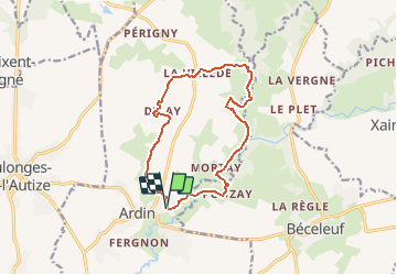

Length
12.9 km

Max alt
117 m

Uphill gradient
220 m
Km-Effort
15.8 km

Min alt
42 m

Downhill gradient
221 m
Boucle
Yes
Creation date :
2014-12-10 00:00:00.0
Updated on :
2014-12-10 00:00:00.0
3h39
Difficulty : Easy

FREE GPS app for hiking
 SityTrail
IGN / Geographical institutes
SityTrail Plus
The world is yours!
About
Trail Walking of 12.9 km to be discovered at New Aquitaine, Deux-Sèvres, Ardin. This trail is proposed by reva17.
Description
Au fil des lavoirs
Positioning
Country:
France
Region :
New Aquitaine
Department/Province :
Deux-Sèvres
Municipality :
Ardin
Location:
Unknown
Start:(Dec)
Start:(UTM)
687946 ; 5149758 (30T) N.
Comments