


Lanslevillard

antignacs
User GUIDE
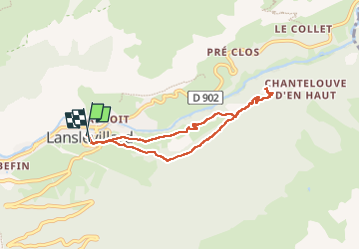

Length
7.3 km

Max alt
1701 m

Uphill gradient
252 m
Km-Effort
10.6 km

Min alt
1482 m

Downhill gradient
240 m
Boucle
Yes
Creation date :
2022-05-19 09:23:06.0
Updated on :
2022-05-19 12:30:05.051
3h06
Difficulty : Very easy

FREE GPS app for hiking
 SityTrail
IGN / Geographical institutes
SityTrail Plus
The world is yours!
About
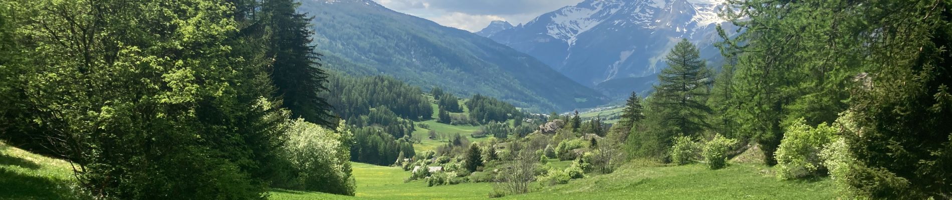
Trail Walking of 7.3 km to be discovered at Auvergne-Rhône-Alpes, Savoy, Val-Cenis. This trail is proposed by antignacs.
Photos


Positioning
Country:
France
Region :
Auvergne-Rhône-Alpes
Department/Province :
Savoy
Municipality :
Val-Cenis
Location:
Unknown
Start:(Dec)
Start:(UTM)
336204 ; 5017231 (32T) N.
Comments