


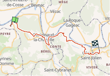
de Meyrals à Domme

phimar_2612
User

Length
14.1 km

Max alt
215 m

Uphill gradient
455 m
Km-Effort
19.8 km

Min alt
66 m

Downhill gradient
360 m
Boucle
No
Creation date :
2022-05-19 07:55:58.26
Updated on :
2022-05-19 14:09:24.736
3h43
Difficulty : Difficult

FREE GPS app for hiking
 SityTrail
IGN / Geographical institutes
SityTrail Plus
The world is yours!
About
Trail Walking of 14.1 km to be discovered at New Aquitaine, Dordogne, Castelnaud-la-Chapelle. This trail is proposed by phimar_2612.
Positioning
Country:
France
Region :
New Aquitaine
Department/Province :
Dordogne
Municipality :
Castelnaud-la-Chapelle
Location:
Unknown
Start:(Dec)
Start:(UTM)
350906 ; 4964939 (31T) N.
Comments