


22 05 20 lac de la Laura au col du Lauchen

jmbilger
User
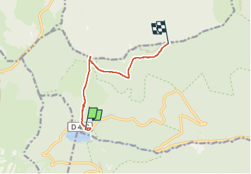

Length
4 km

Max alt
1247 m

Uphill gradient
310 m
Km-Effort
7.3 km

Min alt
947 m

Downhill gradient
63 m
Boucle
No
Creation date :
2022-05-20 08:38:49.0
Updated on :
2022-05-20 11:00:34.618
1h19
Difficulty : Medium

FREE GPS app for hiking
 SityTrail
IGN / Geographical institutes
SityTrail Plus
The world is yours!
About
Trail Walking of 4 km to be discovered at Grand Est, Haut-Rhin, Linthal. This trail is proposed by jmbilger.
Positioning
Country:
France
Region :
Grand Est
Department/Province :
Haut-Rhin
Municipality :
Linthal
Location:
Unknown
Start:(Dec)
Start:(UTM)
353949 ; 5311061 (32T) N.
Comments