


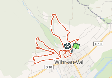
Wihr au val Chapelle

jcschubnel
User

Length
6.2 km

Max alt
478 m

Uphill gradient
259 m
Km-Effort
9.6 km

Min alt
330 m

Downhill gradient
260 m
Boucle
Yes
Creation date :
2022-05-11 12:48:52.401
Updated on :
2022-05-22 16:43:52.836
2h29
Difficulty : Medium

FREE GPS app for hiking
 SityTrail
IGN / Geographical institutes
SityTrail Plus
The world is yours!
About
Trail Walking of 6.2 km to be discovered at Grand Est, Haut-Rhin, Wihr-au-Val. This trail is proposed by jcschubnel.
Positioning
Country:
France
Region :
Grand Est
Department/Province :
Haut-Rhin
Municipality :
Wihr-au-Val
Location:
Unknown
Start:(Dec)
Start:(UTM)
366195 ; 5323842 (32U) N.
Comments