


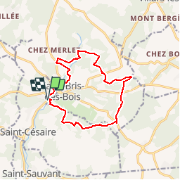
Saint Bris des Bois

reva17
User

Length
13.2 km

Max alt
85 m

Uphill gradient
189 m
Km-Effort
15.7 km

Min alt
36 m

Downhill gradient
190 m
Boucle
Yes
Creation date :
2014-12-10 00:00:00.0
Updated on :
2014-12-10 00:00:00.0
3h30
Difficulty : Medium

FREE GPS app for hiking
 SityTrail
IGN / Geographical institutes
SityTrail Plus
The world is yours!
About
Trail Walking of 13.2 km to be discovered at New Aquitaine, Charente-Maritime, Saint-Césaire. This trail is proposed by reva17.
Description
Belle boucle dans la campagne charentaise, passant par 7 sources et lavoirs, avec une vue sympathique de l'abbaye de Fontdouce.
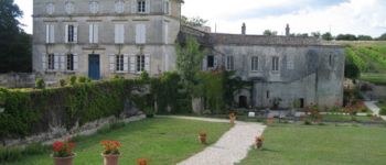
Photos


Positioning
Country:
France
Region :
New Aquitaine
Department/Province :
Charente-Maritime
Municipality :
Saint-Césaire
Location:
Unknown
Start:(Dec)
Start:(UTM)
694705 ; 5070893 (30T) N.
Comments