Trail Walking Barbières - Barbières - Source Barberolle - Photo

Barbières - Source Barberolle

© OpenStreetMap contributors
Length
Length
14.8 km
Max alt
Max alt
865 m
Uphill gradient
Uphill gradient
630 m
Km-Effort
Km-Effort  
23 km
Min alt
Min alt
427 m
Downhill gradient
Downhill gradient
629 m
Boucle
Boucle
Yes
Creation date :
2022-05-28 06:33:14.523
Updated on :
2022-05-29 18:38:41.051

(0 Reviews)

Walking
Walking
4h00
Difficulty : Difficult

Scan this QR Code to open this trail in the SityTrail application

FREE GPS app for hiking

Logo SityTrail SityTrail

IGN / Geographical institutes

Download SityTrail from the App Store Download SityTrail from Google Play

Logo SityTrail SityTrail World

The world is yours!

Download SityTrail from the App Store Download SityTrail from Google Play Download SityTrail on Huawei AppGallery

About

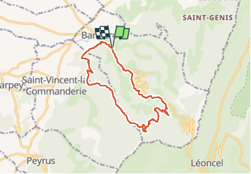
Trail Walking of 14.8 km to be discovered at Auvergne-Rhône-Alpes, Drôme, Barbières. This trail is proposed by Philindy26.

Description

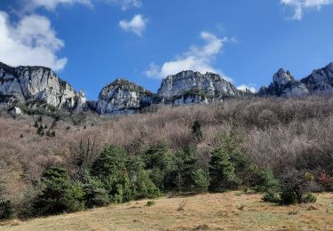
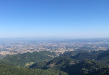
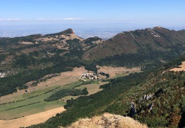
Départ du village de Barbières (434 m), les Monts du Matin...
Géolocalisation (Google Maps) : https://goo.gl/maps/ZrvkuTUteWNG5krC7

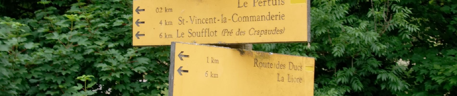
Prendre la direction du Pertuis (440 m), montée par le chemin de la Garde (marque jaune/rouge), les Baumettes (570 m), le Champ des Pins (750 m) et le Soufflot - Pré des Crapaudes (804 m).
Là continuer sur le Maroux de Barbières (740 m), Cany et le Chemin de Cany (760 m) et la Liore (774 m).
Redescendre sur Barbières par la Muletière (580 m) et le Camping Gallo Romain (490 m).

Elevation profile

Photos

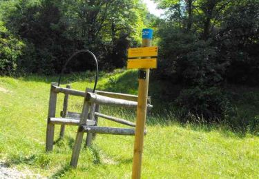
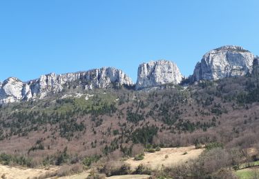
72 photos in total. Please click on a photo to see them all in the gallery.

Positioning

Country:
France
Region :
Auvergne-Rhône-Alpes
Department/Province :
Drôme
Municipality :
Barbières
Location:
Unknown
Start:(UTM)
669260 ; 4979780 (31T) N.

Trails nearby

Trail Walking Beauregard-Baret - Pré de Cinq Sous - Beauregard Baret - Photo
Walking
tracegps

Walking

Medium
(1)
Beauregard-Baret, Auvergne-Rhône-Alpes, Drôme, France
11.6 km | 23 km-effort
5h 0min
Yes
Trail Walking Rochefort-Samson - Les Vachères - Combe d'oyans  - Photo
Walking
randochu

Walking

Difficult
(1)
Rochefort-Samson, Auvergne-Rhône-Alpes, Drôme, France
17.1 km | 28 km-effort
8h 26min
Yes
Trail Walking Saint-Vincent-la-Commanderie - Pierre Chauve 1308m, les Roches de Treillaras, depuis les Condamines - Photo
Walking
tracegps

Walking

Medium
(2)
Saint-Vincent-la-Commanderie, Auvergne-Rhône-Alpes, Drôme, France
12.7 km | 25 km-effort
6h 30min
Yes
Trail Walking Léoncel - Pierre Chauve depuis le Col de Tourniol - Photo
Walking
McTracy004

Walking

Easy
(3)
Léoncel, Auvergne-Rhône-Alpes, Drôme, France
7.9 km | 12.3 km-effort
2h 52min
Yes
Trail Mountain bike Léoncel - Tête de la Dame - Photo
Mountain bike
Thierryb26

Mountain bike

Medium
(1)
Léoncel, Auvergne-Rhône-Alpes, Drôme, France
27 km | 39 km-effort
2h 35min
Yes
Trail Walking Barbières - Traversée Barbières Beauregard-Baret - Photo
Walking
GuyVachet

Walking

Very difficult
Barbières, Auvergne-Rhône-Alpes, Drôme, France
17 km | 28 km-effort
7h 9min
No
Trail Walking Saint-Vincent-la-Commanderie - 26 st Vincent commanderie zel - Photo
Walking
himba26100

Walking

Easy
Saint-Vincent-la-Commanderie, Auvergne-Rhône-Alpes, Drôme, France
14.2 km | 22 km-effort
6h 5min
Yes
Trail Walking Barbières - Barbière Pierre Chauve  - Photo
Walking
alinetpierre

Walking

Medium
Barbières, Auvergne-Rhône-Alpes, Drôme, France
8.1 km | 15.5 km-effort
2h 25min
Yes
Trail Walking Léoncel - Pas de Sausse pas De Chovet, arche de Rucla - Photo
Walking
alinetpierre

Walking

Medium
Léoncel, Auvergne-Rhône-Alpes, Drôme, France
9.9 km | 14.6 km-effort
2h 43min
Yes


Close
My subscriptions