Trail Walking Barbières - Traversée Barbières Beauregard-Baret - Photo

Traversée Barbières Beauregard-Baret

© OpenStreetMap contributors
Length
Length
17 km
Max alt
Max alt
879 m
Uphill gradient
Uphill gradient
826 m
Km-Effort
Km-Effort  
28 km
Min alt
Min alt
421 m
Downhill gradient
Downhill gradient
837 m
Boucle
Boucle
No
Creation date :
2024-03-21 08:04:00.073
Updated on :
2024-03-22 07:28:37.102

(0 Reviews)

Walking
Walking
7h09
Difficulty : Very difficult

Scan this QR Code to open this trail in the SityTrail application

FREE GPS app for hiking

Logo SityTrail SityTrail

IGN / Geographical institutes

Download SityTrail from the App Store Download SityTrail from Google Play

Logo SityTrail SityTrail World

The world is yours!

Download SityTrail from the App Store Download SityTrail from Google Play Download SityTrail on Huawei AppGallery

About

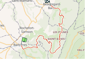
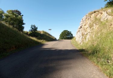
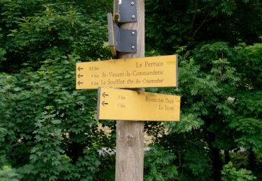
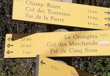
Trail Walking of 17 km to be discovered at Auvergne-Rhône-Alpes, Drôme, Barbières. This trail is proposed by GuyVachet.

Description

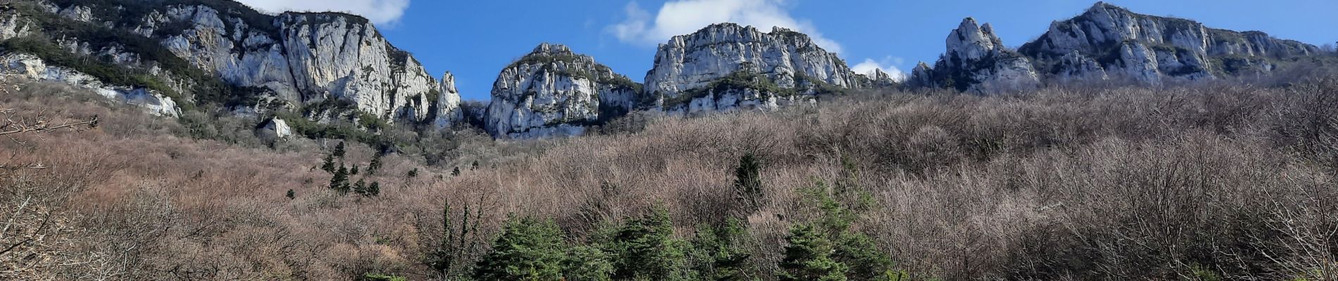
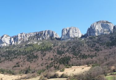
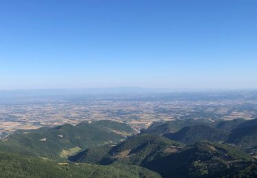
Traversée au pied des Monts du Matin. Ces premiers contreforts du Vercors marquant l'entrée dans les Alpes depuis la Vallée du Rhône.

Elevation profile

Photos

Positioning

Country:
France
Region :
Auvergne-Rhône-Alpes
Department/Province :
Drôme
Municipality :
Barbières
Location:
Unknown
Start:(UTM)
668931 ; 4980288 (31T) N.

Trails nearby

Trail Walking Beauregard-Baret - Pré de Cinq Sous - Beauregard Baret - Photo
Walking
tracegps

Walking

Medium
(1)
Beauregard-Baret, Auvergne-Rhône-Alpes, Drôme, France
11.6 km | 23 km-effort
5h 0min
Yes
Trail Walking Rochefort-Samson - Les Vachères - Combe d'oyans  - Photo
Walking
randochu

Walking

Difficult
(1)
Rochefort-Samson, Auvergne-Rhône-Alpes, Drôme, France
17.1 km | 28 km-effort
8h 26min
Yes
Trail Walking Saint-Vincent-la-Commanderie - Pierre Chauve 1308m, les Roches de Treillaras, depuis les Condamines - Photo
Walking
tracegps

Walking

Medium
(2)
Saint-Vincent-la-Commanderie, Auvergne-Rhône-Alpes, Drôme, France
12.7 km | 25 km-effort
6h 30min
Yes
Trail Walking Léoncel - Pierre Chauve depuis le Col de Tourniol - Photo
Walking
McTracy004

Walking

Easy
(3)
Léoncel, Auvergne-Rhône-Alpes, Drôme, France
7.9 km | 12.3 km-effort
2h 52min
Yes
Trail Walking Saint-Vincent-la-Commanderie - 26 st Vincent commanderie zel - Photo
Walking
himba26100

Walking

Easy
Saint-Vincent-la-Commanderie, Auvergne-Rhône-Alpes, Drôme, France
14.2 km | 22 km-effort
6h 5min
Yes
Trail Walking Barbières - Barbière Pierre Chauve  - Photo
Walking
alinetpierre

Walking

Medium
Barbières, Auvergne-Rhône-Alpes, Drôme, France
8.1 km | 15.5 km-effort
2h 25min
Yes
Trail Walking Léoncel - Pierre Chauve - Col de Tourniol - Photo
Walking
Philindy26

Walking

Easy
Léoncel, Auvergne-Rhône-Alpes, Drôme, France
6.4 km | 10.8 km-effort
2h 30min
Yes
Trail Walking Barbières - Barbières - Source Barberolle - Photo
Walking
Philindy26

Walking

Difficult
Barbières, Auvergne-Rhône-Alpes, Drôme, France
14.8 km | 23 km-effort
4h 0min
Yes
Trail Walking Beauregard-Baret - Pré de cinq sous - Photo
Walking
cousam

Walking

Medium
Beauregard-Baret, Auvergne-Rhône-Alpes, Drôme, France
8.8 km | 17.4 km-effort
3h 14min
Yes


Close
My subscriptions