Trail Hybrid bike Cerfontaine - Boucle - Cerfontaine - Lompret - Chimay - Eppe -Montbliard - Rance - Photo

Boucle - Cerfontaine - Lompret - Chimay - Eppe -Montbliard - Rance

© OpenStreetMap contributors
Length
Length
55 km
Max alt
Max alt
298 m
Uphill gradient
Uphill gradient
745 m
Km-Effort
Km-Effort  
65 km
Min alt
Min alt
177 m
Downhill gradient
Downhill gradient
745 m
Boucle
Boucle
Yes
Creation date :
2022-05-29 18:55:59.971
Updated on :
2022-05-31 12:53:06.048

(0 Reviews)

Hybrid bike
Hybrid bike
0m
Difficulty : Very easy

Scan this QR Code to open this trail in the SityTrail application

FREE GPS app for hiking

Logo SityTrail SityTrail

IGN / Geographical institutes

Download SityTrail from the App Store Download SityTrail from Google Play

Logo SityTrail SityTrail World

The world is yours!

Download SityTrail from the App Store Download SityTrail from Google Play Download SityTrail on Huawei AppGallery

About

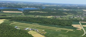
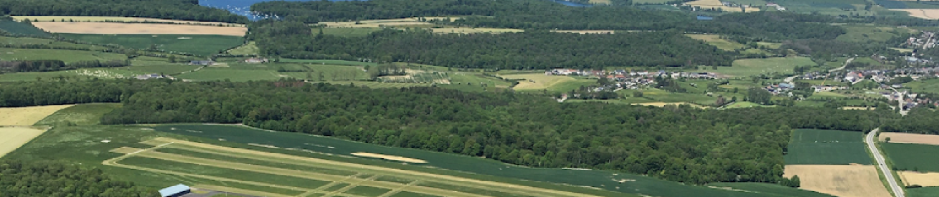
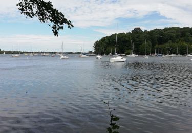
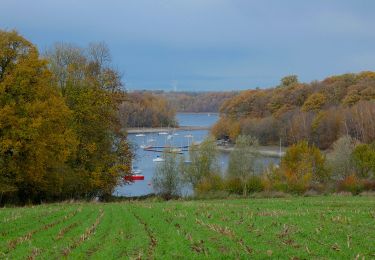
Trail Hybrid bike of 55 km to be discovered at Wallonia, Namur, Cerfontaine. This trail is proposed by jeanphi.hennebert.

Description

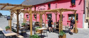
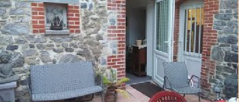
Balade en campagne et villages avec des haltes et restos.

Elevation profile

Photos

Points of interest

Point of interest Chimay - Auberge de l'eau blanche - Photo
jeanphi.hennebert
Point of interest Cerfontaine - Aerodrome Froidchapelle - Photo
jeanphi.hennebert
Point of interest Eppe-Sauvage - Eppe-La vie sauvage - Photo
jeanphi.hennebert
EPPE-SAUVAGE 
Point of interest Baives - Estaminet Dom&Paco - Photo
jeanphi.hennebert

Positioning

Country:
Belgium
Region :
Wallonia
Department/Province :
Namur
Municipality :
Cerfontaine
Location:
Unknown
Start:(UTM)
599128 ; 5556279 (31U) N.

Trails nearby

Trail Walking Cerfontaine - cerfontaine  - Photo
Walking
kilou07

Walking

Very easy
(1)
Cerfontaine, Wallonia, Namur, Belgium
6.5 km | 7.9 km-effort
1h 42min
Yes
Trail Walking Cerfontaine - Balade au village de la source de l'eau d'Heure Cerfontaine - Photo
Walking
GUIDE
Desrumaux

Walking

Easy
(3)
Cerfontaine, Wallonia, Namur, Belgium
11.6 km | 14.7 km-effort
3h 11min
Yes
Trail Walking Froidchapelle - Le Tour du lac de la Plate Taille - Photo
Walking
GUIDE
Desrumaux

Walking

Easy
(3)
Froidchapelle, Wallonia, Hainaut, Belgium
15.8 km | 18 km-effort
4h 0min
Yes
Trail Walking Froidchapelle - Froidchapelle - Entre Champs et Forets - Photo
Walking
GUIDE
Desrumaux

Walking

Easy
(1)
Froidchapelle, Wallonia, Hainaut, Belgium
14.3 km | 17.1 km-effort
3h 20min
Yes
Trail Walking Froidchapelle - Du lac de l'Eau d'Heure vers la  Plate Taille - Photo
Walking
GUIDE
Desrumaux

Walking

Easy
(4)
Froidchapelle, Wallonia, Hainaut, Belgium
13.7 km | 16.2 km-effort
3h 20min
Yes
Trail On foot Froidchapelle - Balade au Lac de l'Eau d'Heure - Photo
On foot
GUIDE
Desrumaux

On foot

Easy
Froidchapelle, Wallonia, Hainaut, Belgium
8.9 km | 10.8 km-effort
2h 12min
Yes
Trail Walking Froidchapelle - La balade du bois du Grand Oupia aux lacs de l'eau d'heure - Photo
Walking
GUIDE+

Walking

Medium
(4)
Froidchapelle, Wallonia, Hainaut, Belgium
8.7 km | 9.9 km-effort
2h 15min
Yes
Trail Walking Froidchapelle - Balade au Lac de la Plate Taille - Photo
Walking
GUIDE
Desrumaux

Walking

Medium
Froidchapelle, Wallonia, Hainaut, Belgium
8.4 km | 9.8 km-effort
2h 57min
Yes
Trail On foot Froidchapelle - Promenade d'Hernoy - chemin de fer - Photo
On foot
GUIDE+

On foot

Easy
Froidchapelle, Wallonia, Hainaut, Belgium
5.8 km | 6.8 km-effort
1h 32min
Yes


Close
My subscriptions