Trail Walking Longes - 69-longes-Mont-Monnet-Ste-Croix-Jarez-20km-800m - Photo

69-longes-Mont-Monnet-Ste-Croix-Jarez-20km-800m

 SyMA
SyMA

User

© OpenStreetMap contributors
Length
Length
20 km
Max alt
Max alt
778 m
Uphill gradient
Uphill gradient
795 m
Km-Effort
Km-Effort  
31 km
Min alt
Min alt
386 m
Downhill gradient
Downhill gradient
797 m
Boucle
Boucle
Yes
Creation date :
2022-06-09 07:01:41.478
Updated on :
2022-06-09 17:33:49.739

(0 Reviews)

Walking
Walking
6h05
Difficulty : Difficult

Scan this QR Code to open this trail in the SityTrail application

FREE GPS app for hiking

Logo SityTrail SityTrail

IGN / Geographical institutes

Download SityTrail from the App Store Download SityTrail from Google Play

Logo SityTrail SityTrail World

The world is yours!

Download SityTrail from the App Store Download SityTrail from Google Play Download SityTrail on Huawei AppGallery

About

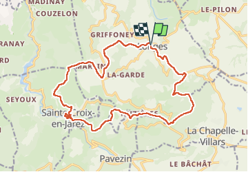
Trail Walking of 20 km to be discovered at Auvergne-Rhône-Alpes, Rhône, Longes. This trail is proposed by SyMA.

Description

départ parking avec WC
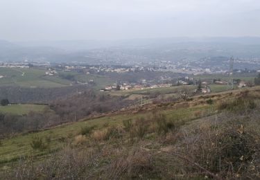
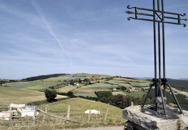
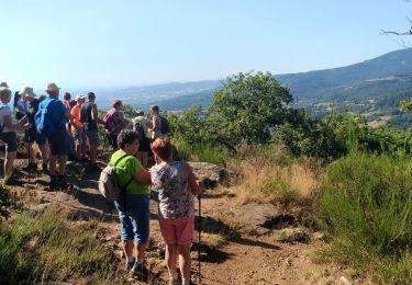
Belle rando (panoramas - Abbatiale)
Pique nique possible à Ste Croix en Jarez ouest de abbatiale prés de stade

Elevation profile

Photos

Positioning

Country:
France
Region :
Auvergne-Rhône-Alpes
Department/Province :
Rhône
Municipality :
Longes
Location:
Unknown
Start:(UTM)
631897 ; 5040398 (31T) N.

Trails nearby

Trail Walking Trèves - Chemin de Fer à Trèves - Photo
Walking
tracegps

Walking

Medium
(1)
Trèves, Auvergne-Rhône-Alpes, Rhône, France
4.5 km | 6.8 km-effort
1h 30min
Yes
Trail Walking Châteauneuf - 42-barrage-couzon-ste-croix-retau-17km-550m - Photo
Walking
SyMA

Walking

Difficult
Châteauneuf, Auvergne-Rhône-Alpes, Loire, France
17.3 km | 25 km-effort
4h 47min
Yes
Trail Walking Châteauneuf - 42-barragecouzon-12km-320m - Photo
Walking
SyMA

Walking

Easy
Châteauneuf, Auvergne-Rhône-Alpes, Loire, France
12 km | 16.3 km-effort
3h 21min
Yes
Trail Walking Longes - 1 septembre 2022 longes - Photo
Walking
Parodie69

Walking

Difficult
Longes, Auvergne-Rhône-Alpes, Rhône, France
23 km | 35 km-effort
6h 40min
Yes
Trail Walking Sainte-Croix-en-Jarez - 42-ste-Croix-Jarez-12km-440m-mai22 - Photo
Walking
SyMA

Walking

Medium
Sainte-Croix-en-Jarez, Auvergne-Rhône-Alpes, Loire, France
12 km | 17.9 km-effort
3h 5min
Yes
Trail On foot La Chapelle-Villars - Pilat N°30: des «Côteaux à les Haies» - Photo
On foot
PRO

On foot

Difficult
La Chapelle-Villars, Auvergne-Rhône-Alpes, Loire, France
29 km | 37 km-effort
8h 27min
Yes
Trail Walking Pavezin - Crêt de Baronnette - Photo
Walking
gerard1222

Walking

Easy
Pavezin, Auvergne-Rhône-Alpes, Loire, France
9.1 km | 13.6 km-effort
3h 20min
Yes
Trail Walking Châteauneuf - Autour de Sainte Croix en Jarez - Châteauneuf   - Photo
Walking
tracegps

Walking

Difficult
Châteauneuf, Auvergne-Rhône-Alpes, Loire, France
28 km | 42 km-effort
7h 0min
Yes
Trail Walking Trèves - Randonnée de Trèves à Dizimieux - Photo
Walking
tracegps

Walking

Medium
Trèves, Auvergne-Rhône-Alpes, Rhône, France
7.2 km | 10.3 km-effort
2h 0min
Yes


Close
My subscriptions