


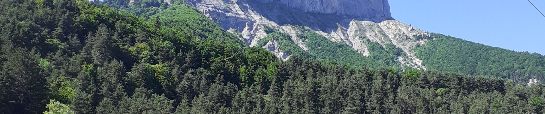
mont aiguille

cousam
User
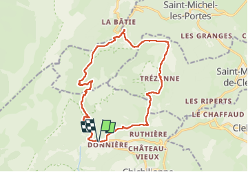

Length
17.8 km

Max alt
1706 m

Uphill gradient
1102 m
Km-Effort
32 km

Min alt
1012 m

Downhill gradient
1105 m
Boucle
Yes
Creation date :
2022-06-11 06:24:43.806
Updated on :
2022-06-11 17:47:25.327
7h48
Difficulty : Medium

FREE GPS app for hiking
 SityTrail
IGN / Geographical institutes
SityTrail Plus
The world is yours!
About
Trail Walking of 17.8 km to be discovered at Auvergne-Rhône-Alpes, Isère, Chichilianne. This trail is proposed by cousam.
Photos


Positioning
Country:
France
Region :
Auvergne-Rhône-Alpes
Department/Province :
Isère
Municipality :
Chichilianne
Location:
Unknown
Start:(Dec)
Start:(UTM)
701538 ; 4966371 (31T) N.
Comments