


Le prec

JPS73
User
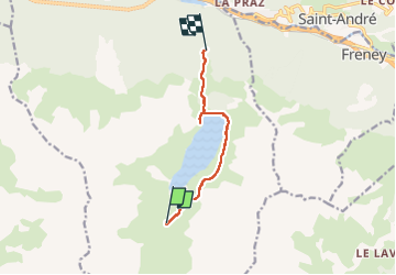

Length
7.1 km

Max alt
2342 m

Uphill gradient
166 m
Km-Effort
11 km

Min alt
1690 m

Downhill gradient
687 m
Boucle
No
Creation date :
2022-06-12 11:46:28.823
Updated on :
2022-06-12 15:04:01.18
2h24
Difficulty : Medium

FREE GPS app for hiking
 SityTrail
IGN / Geographical institutes
SityTrail Plus
The world is yours!
About
Trail Walking of 7.1 km to be discovered at Auvergne-Rhône-Alpes, Savoy, Orelle. This trail is proposed by JPS73.
Positioning
Country:
France
Region :
Auvergne-Rhône-Alpes
Department/Province :
Savoy
Municipality :
Orelle
Location:
Unknown
Start:(Dec)
Start:(UTM)
308627 ; 5003200 (32T) N.
Comments