


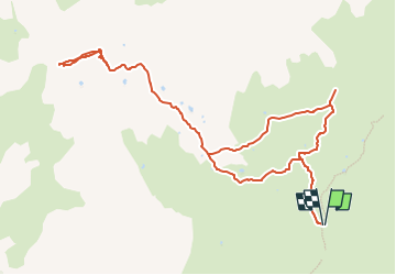
Mont Froid via col de Solliéres

geoffrayLayeux
User

Length
12.6 km

Max alt
2788 m

Uphill gradient
675 m
Km-Effort
22 km

Min alt
2122 m

Downhill gradient
674 m
Boucle
Yes
Creation date :
2022-06-17 17:31:52.686
Updated on :
2022-06-17 17:32:48.938
4h53
Difficulty : Very difficult

FREE GPS app for hiking
 SityTrail
IGN / Geographical institutes
SityTrail Plus
The world is yours!
About
Trail Walking of 12.6 km to be discovered at Auvergne-Rhône-Alpes, Savoy, Val-Cenis. This trail is proposed by geoffrayLayeux.
Positioning
Country:
France
Region :
Auvergne-Rhône-Alpes
Department/Province :
Savoy
Municipality :
Val-Cenis
Location:
Lanslebourg-Mont-Cenis
Start:(Dec)
Start:(UTM)
333859 ; 5009579 (32T) N.
Comments