


Jakobsweg4: Haggenegg-Brunnen

steger12
User
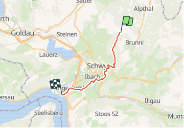

Length
13 km

Max alt
1406 m

Uphill gradient
51 m
Km-Effort
16.9 km

Min alt
435 m

Downhill gradient
1013 m
Boucle
No
Creation date :
2014-12-10 00:00:00.0
Updated on :
2014-12-10 00:00:00.0
--
Difficulty : Unknown

FREE GPS app for hiking
 SityTrail
IGN / Geographical institutes
SityTrail Plus
The world is yours!
About
Trail Other activity of 13 km to be discovered at Schwyz, Schwyz, Schwyz. This trail is proposed by steger12.
Positioning
Country:
Switzerland
Region :
Schwyz
Department/Province :
Schwyz
Municipality :
Schwyz
Location:
Unknown
Start:(Dec)
Start:(UTM)
475976 ; 5210954 (32T) N.
Comments