


2022-06-24 Marche TGV Pralognan Refuge du Col de la Vanoise

holtzv
User GUIDE
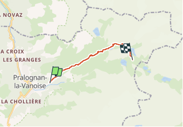

Length
7.1 km

Max alt
2517 m

Uphill gradient
866 m
Km-Effort
15.7 km

Min alt
1646 m

Downhill gradient
3 m
Boucle
No
Creation date :
2022-06-24 14:40:14.212
Updated on :
2022-06-29 17:01:36.513
2h37
Difficulty : Medium

FREE GPS app for hiking
 SityTrail
IGN / Geographical institutes
SityTrail Plus
The world is yours!
About
Trail Walking of 7.1 km to be discovered at Auvergne-Rhône-Alpes, Savoy, Pralognan-la-Vanoise. This trail is proposed by holtzv.
Description
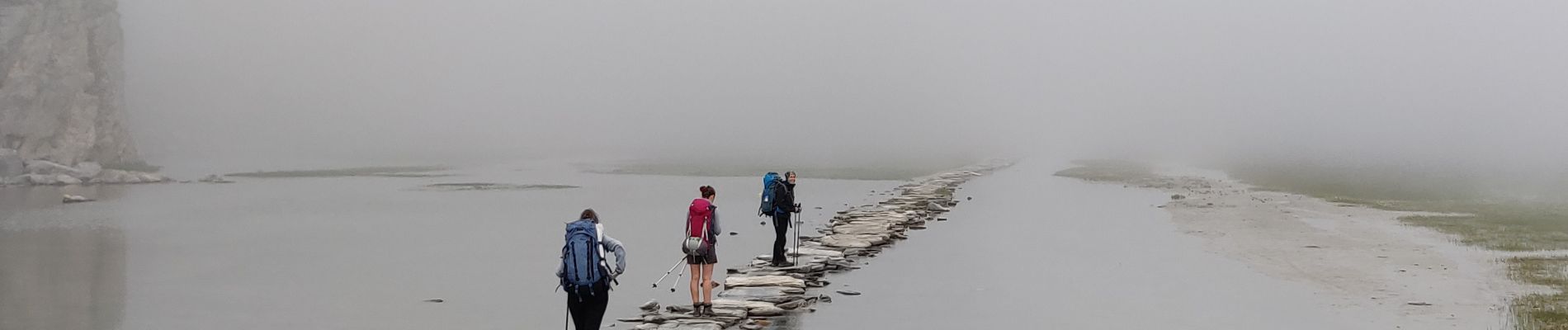
Etape 01 - Marche de Pralognan Les Fontanettes - Refuge Col de la Vanoise
Photos


Positioning
Country:
France
Region :
Auvergne-Rhône-Alpes
Department/Province :
Savoy
Municipality :
Pralognan-la-Vanoise
Location:
Unknown
Start:(Dec)
Start:(UTM)
322662 ; 5027770 (32T) N.
Comments